
Altitude: sea level. Population: 35,000.
Poatal code: DK-9900. Telephone code: 08.
HOTELS. Jutlandia, Havneplads 1, 170 Hoffmanns Hotel, Danmarksgade 62, 127 Marie-nonen, Danmarksgade 40, 71 Park, Jernbanegade 7, 80 Motel Lisboa, Sondergade 248, 82 Turisthotellet, Margretheve 5-7, 44 b. YOUTH HOSTEL: Buhlsvej 6. CAMP SITE: Apholmenvej 40.
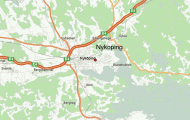
The busy Danish port and industrial town (shipyards, engineering) of Frederikshavn in northern Jutland was known as Fladstrand until 1818, when it received its municipal charter. From its fortified natural harbour there are ferry services to Gothenburg, Larvik, Fredrikstad and Oslo.
SIGHTS. In the middle of the town, by the harbour, stands the old Powder Tower (Krundtt&rnet, 1 688), which now houses a collection of weapons dating from about 1600 onwards. To the N of the fishing harbour is the oldest part of the
Church tower at Skagen, half buried by sand town, Fiskerklyngen, with many well-preserved 17th c. houses. 4 km (21 miles) from the mid-town, by way of Gaerumvej and Bronderslevvej, is a 58 m (190 ft) high observation tower, Cloostarnet (alt. 165 m 540 ft) from which there are attractive views. Close by, in Gaerumvej are the Iron Age Cellars (Jernalder-kaeldrene), with material ofthe Early Iron Age found in the locality. 3 km (2 miles) SW by way of Mollehus Alle, set in 50 hectares (125 acres) of wooded parkland, is the manor-house of Bangsbo (1750), now a museum, with models of ships, figureheads and a collection of more than 1000 stones with carvings or inscriptions, the oldest of them dating from prehistoric times. To the S of the town lies Pikkerbakken, a small range of very low hills, from which there are magnificent views of Frederikshavn, the surrounding countryside and the sea.
SURROUNDINGS. The ferry takes 1 hour 40 minutes to reach the island of Laeso, in the Kattegat (area 116 sq. km (45 sq. miles), pop. 2800; in Vester© Havn Carlsens Hotel, 12 Somandshjem, 28 youth hostel, camp site; in 0sterby Hotel, 9 Somandshjem, 14 camp site). Two-thirds of the island is uninhabited; at the N end is Hojsand, a dune up to 28 m (90 ft) high. The main town on the island, Byrum, has a local museum in a 200-year-old farmhouse. At low tide it is possible to drive in a horse carriage to the little island of Hornfiskron.
12 km (7 miles) S of Frederikshavn on E3 (A10) is the fishing port and seaside resort of Saeby (pop. 17,500; Viking Hotel, 44 Dania, 16 Harmonien, 30 youth hostel; several camp sites). Near the beach is St Mary’s Church which is richly decorated with frescoes (c. 1500), and which originally belonged to a monastery founded in 1469.
N of Frederikshavn A10 runs through a region of fields, woodland, heath and dunes. In 38 km (24 miles) (2-5 km (11 miles) before Skagen) a road (signposted) goes off on the right to a parking place
05 km (500 yds) E, from which a sandy footpath leads in 10 minutes to the tower of the old Skagen church, half buried in blown sand; the nave was demolished in 1795.
2.5 km (11 miles) farther on A10 comes to Skagen, in English traditionally the Skaw, Denmark’s most northerly town, situated on the tip of Jutland (pop. 14,000; Skagen Hotel, 86 SP; Brondums Hotel, 67
Foldens Hotel, 26 in Gamle Skagen Jeckels Hotel, 90 Ruth’s Hotel, 110 holiday houses). Skagen is a resort much favoured by artists. The newer part of the town extends along the Kattegat among the dunes; it has a fishing harbour (fish auction hall), a small museum of art (painting and sculpture), an open-air museum and a town hall built in 1968. The older part of the town, Gamle Skagen, lies on the Skagerrak.
The road continues 3-5 km (2 miles) beyond Skagen and ends at a parking place in the dunes (restaurant) to the rear of the Grenen lighthouse (44 m 145 ft high). Near here is the grave of the Danish poet and novelist Holger Drachmann (1846-1908), the singer of the sea”. From the parking place visitors can drive in a sand-worm” (sandorm a tractor drawing a passenger-carrying trailer) or in dry weather in their own car (to the left), or, best of all, can walk (15 minutes) to the northern tip of Jutland, where the waters of the Skagerrak and Kattegat surge against one another (swimming highly dangerous).
Frederikshavn Denmark Map Photo Gallery