The Madison Valley Ennis to West Yellowstone
ESTIMATED LENGTH: 91 miles
Highlights: Madison River, Ennis Lake, Quake Lake, Hebgen Lake
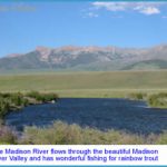
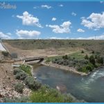
Getting there: Leave I-90 at Three Forks and take US 287 south to Ennis, or exit in Bozeman, drive south on US 191 to Four Corners, head west on MT 84 to Norris, and turn south on US 287 over the pass through McAllister to Ennis. ant to see a fly fisherman genuflect? Just mention the Madison River. As American trout streams go, none has more cachet among anglers. And although the entire 100-plus miles of the Madison provide excellent fishing, it’s the 50-Mile Riffle above Ennis that graces the covers of fly-fishing brochures and fills with drift boats for eight months of the year. The Madison Valley is broad and sweeping, with US 287 roughly paralleling the river, though usually from a distance. The route has numerous river-access points. And if you don’t have a driftboat or raft, there are sections above and below the riffle suited for wading. At McAllister, just north of Ennis, a dirt road goes east to the dam backing up Ennis Lake; below the dam is terrific brown and rainbow trout water. Just below Quake Lake, at the upper end of the valley, is a wading-friendly stretch marked by Three Dollar Bridge, so named for the toll once charged to cross there.
There are other reasons to be in the Madison Valley, of course most of them related to outdoor activities and scenery. At Cameron, a road goes east toward the Madison Range and a trailhead that leads to 10,876-foot Sphinx Mountain, the prominent peak whose name requires no explanation.
The farther up the valley you go, the narrower it gets, and the sparkling river comes into view. Off to the left is 11,292-foot Hilgard Peak, second only to Lone Mountain as the tallest in the Madison Range. Eventually the highway begins to bend toward the east. Look for the turnoff across Three Dollar Bridge to Cliff and Wade lakes, part of a string of jewels just over the hill that feature outstanding fishing and the rustic Wade Lake Resort cabins (one of our favorite getaways).
Back on US 287, you’ll pass MT 87 and drive past an attractive collection of summer homes into Madison Canyon. Immediately coming into view is one of the most unique geologic features in southwest Montana: Quake Lake. Looking up to the south, you’ll see where, on August 17, 1959, an earthquake registering 7.3 on the Richter scale sent 80 million tons of rock and debris into the river and up the other side of the valley. Twenty-eight people died many remain buried in the rubble to this day and the slide created a natural dam that formed Quake Lake. The eerie bleached spires of drowned pine trees still poke through the lake’s surface. You can walk to the site of the natural dam, which was breached not long after the quake to avoid a future dam breach that might imperil residents and fishermen downstream Stop at the Earthquake Lake Visitor Center, where you can read more about the events.

