
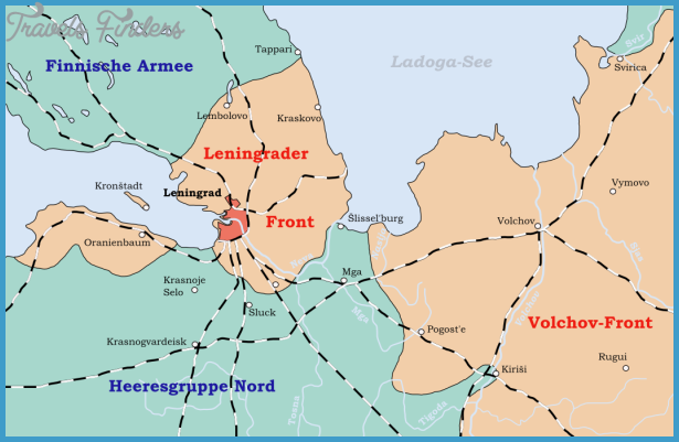
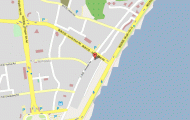
LENINGRAD
The former Petersburg or Sankt Petersburg as the Russians called it. Between 1914 and 1924 it was called Petrograd. This is Leningrad the city of architecture, famous for its museums, port and bridges. It is the second most important city after Moscow and also the second largest with an area of 570 square kilometers with 4.9 million inhabitants. Most important is its position on the Neva delta in the Finnish Gulf, which is part of the Baltic Sea. The harbor city which is the terminus for 12 railway lines, is not only the center of Soviet sea trade, but is also important for inland shipping.
There are connections to the White Sea via canals as well as to the Caspian Sea. Leningrad is also a university city, has 40 schools of further education and 375 institutes and educational establishments, 2000 libraries, 50 museums, 15 theaters and a philharmonic orchestra. Chemical, optics and foodstuff industries are important as well as mass production of ships, turbines, generators, tools and tractors. A textile industry, a large number of printing houses and the production of radio and television equipment complete the industrial picture of Leningrad.


