Boney Mountain State Wilderness And Point Mugu State Park
Hiking Distance: 7.8 Miles Hiking Time: 4 Hours
Configuration: Out-And-Back With Large Loop Elevation Gain: 1,000 Feet Difficulty: Moderate To Strenuous
Exposure: A Mix Of Shaded Canyon And Exposed Grassland And Hillsides Dogs: Allowed In Rancho Sierra Vista/Satwiwa But Not Allowed In Point Mugu State Park
Old Boney Trail Map To Danielson Monument Photo Gallery
Maps: U.S.G.S. Newbury Park Point Mugu State Park Map Tom Harrison Maps: Point Mugu State Park Trail Map
The Boney Mountain State Wilderness Area Occupies The Eastern Portion Of Point Mugu State Park. The Centerpiece Of The Preserved Area Is Boney
Mountain, A Rocky, Jagged Formation That Rises 1,500 Feet Above Sycamore Canyon. The Scenic Mountain Contains Four Of The Highest Peaks In The Coastal Santa Monica Range, Including Well-Known Sandstone Peak (Hike 130).
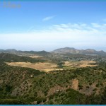
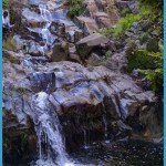
This Hike Begins In Rancho Sierra Vista/Satwiwa And Loops Through The Wilderness Area At The Northern End Of Point Mugu State Park. The Route Follows The Old Boney Trail In Upper Sycamore Canyon To The Danielson Monument, A Stone Monument With A Metal Arch Honoring Richard Danielson. Danielson Donated The Ranch To The National Park Service For Preservation As An Open Space. Near The Monument Is The Old Cabin Site Of Richard Danielson Jr., Where A Rock Fireplace Still Remains. En Route To The Monument, The Trail Passes Sycamore Canyon Falls, A 70-Foot Cascade In A Lush Box Canyon Along The Riparian Corridor Of Big Sycamore Creek. The Hike Weaves Through Open Grassland, Wooded Forests, And A Stream-Fed Canyon. Mountain Overlooks Offer Close-Up Views Of The Sheer Rock Face Of Boney Mountain.
To The Trailhead
From Highway 101/Ventura Freeway In Newbury Park, Exit On Wendy Drive. Drive 2 Miles South To Lynn Road And Turn Right. Continue 1.7 Miles To Via Goleta, The Park Entrance Road. (En Route, Lynn Road Becomes West Potrero Road.) Turn Left Into The Park And Drive 0.7 Miles To The Main Parking Lot At The End Of The Road.
The Hike
Take The Posted Trail Past The Restrooms A Quarter Mile To The Service Road At The Satwiwa Native American Indian Culture Center. Bear Right On The Road, Entering Point Mugu State Park. As You Approach The Ridge Overlooking Big Sycamore Canyon, Take The Boney Mountain Trail To The Left Along The Brink Of The Canyon. Climb A Short Hill, Passing The Satwiwa Loop Trail On The Left, And Continue Around To A Ridge And A Trail Split. Take The Right Fork, Descending Down To The Forested Canyon Floor And A Junction With The Upper Sycamore Canyon Trail At 1.3 Miles (The Return Route).
Begin The Loop Straight Ahead Under A Canopy Of Oaks, Sycamores, And Bay Laurel To A U-Shaped Right Bend. Detour 100 Yards To The Left To Seasonal Sycamore Canyon Falls In A Rock-Walled Box Canyon. Return To The Old Boney Trail, And Continue Up The Hillside On The North Flank Of Boney Mountain To An Overlook Of Sycamore Canyon, The Oxnard Plain, And The
Channel Islands. Inland Views Extend To The Los Padres National Forest. Steadily Climb To A Posted Junction And Views Of The Rounded Rock Formations Of Upper Boney Mountain. Detour 0.3 Miles On The Left Fork, Dropping Down And Crossing A Seasonal Drainage To The Danielson Monument At The End Of The Trail. To The Right Is The Old Cabin Site With The Remaining Rock Chimney And Fireplace.
Return To The Old Boney Trail, And Walk Through The Tall Brush, Gaining Elevation While Passing Occasional Overlooks That Span From Point Mugu State Park To The Pacific Ocean. Gradually Descend To A Signed Junction With The Fossil Trail At 4.4 Miles. Straight Ahead, The Old Boney Trail Leads 2.1 Miles To The Blue Canyon Trail, Part Of The Backbone Trail. (To The West, The Backbone Trail Connects To The Danielson Ranch In Big Sycamore Canyon Hike 1 32. To The East, The Trail Leads To Sandstone Peak Hike 130.)

