
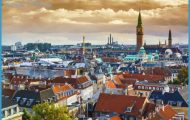
Orebro, capital of the Narke region, lies in the plain on both sides of the Svarta, near the W end of Lake Hjalmar. It has a long tradition as a commercial area, having served for centuries as a link between the mining region and the farming country of central Sweden. It developed around a ford on the SvartS, which from the end of the 13th c. was protected by a tower 25 m (80 ft) high, built by Birger Jarl to watch over and defend the river crossing. On the foundations.
Orebro Sweden Map Photo Gallery


Olaus Petri kyrka, Svampen Stockholm Norrkoping Orebro Castle of this tower the castle was built. It played an important role, on many occasions, as the meeting place of the Riksdag (Swedish parliament).
SIGHTS. The central feature ofthe town is the Stortorg. At the W end of this stands St Nicholas’s Church (Nikolaikyrka, 18th c.), in which the French marshal Bernadotte was chosen as heir to the throne in 181 0. The church also contains the tomb of Sweden’s legendary national hero, Engelbrekt Engelbrektsson. Opposite the church, in front of the neo-Gothic Town Hall (1856-62), is a bronze statue of Engelbrekt (Qvarnstrom, 1 865). To the W of St Nicholas’s, on the banks of the SvartS, are the Concert Hall (Konserthus) and, in the same building, the Municipal Library. From the W end of the Stortorg Drottninggatan runs S to the Medborgarhus (Citizens’ House, 1 964), with a youth club and the Hjalmar Bergman Theatre, named after the great Swedish novelist and dramatist, a native of the town.
A little way N of the Stortorg, by way of Kungsgatan, we come to the venerable old Castle, on an island in the river. It is a 1 6th c. Renaissance structure with four corner towers (restored 1897-1900), which now houses the provincial government offices. To the SE ofthe Castle is the Castle Park, with the Stromparterren restaurant, and on the E side of the park are the Art Gallery (temporary exhibitions) and the Provincial Museum (local history and culture). From the Castle, the Kanalvag runs along the S side of the river to the attractive Municipal Park, tothe E of which, on the banks ofthe river, is the Wadkoping open-air museum. with a number of old wooden houses, including the Kungsstuga (King’s House, 15th or 16th c.) and the Borgarstuga (1 7th c.).
To the N of the town, in Storgatan, is the Olaus Petri Church (1912), in front of which stands a bronze monument (by Nils Sjorgren) to the brothers Laurentius and Olaus Petri, leading figures ofthe Reformation in Sweden during the reign of Gustavus Vasa, Farther NE a 60 m (200 ft) high water-tower, called Svampen (the mushroom), has a restaurant from which there are extensive views over the surrounding countryside.
SURROUNDINGS. SW of the town, on the Karlstad road, is the Gustavsvik open-air swimming pool. A few miles E of Orebro lies the Oset bird sanctuary (land area 45 hectares (110 acres), water area 85 hectares (21 0 acres)), frequented by many species of birds. 10 km (6 miles) NE on the old Fellingsbrovag stands the Nastasten, a runic stone with the inscription Tored had this stone set up for Lydbjorn, his good son”. 1 5 km (1 0 miles) from Orebro in the same direction is the manor-house of Ekebergs Herregard, from which Gustavus Vasa’s second wife, Margareta Leijonhufvud, came. The famous Ekberg marble, used intheTown Houseand Dramatic Theatre in Stockholm, came from the nearby village of Glanshammar, which has a church dating from the middle ofthe 12th c. One ofthe richest churches in the province, it has magnificent Renaissance paintings and a fine processional crucifix. 200 m (220 yds) W of the church are the old silver-mines which gave the place its name. (Silver-mining ceased in 1 530.) NE of the church is a ship burial, part of a cemetery which extends along the road to Fellingsbro. 3 km (2 miles) W of the middle of the town stands the old 16th c. manor-house of Karlslundsgard, now owned by the town. Some rooms of the house are used for occasional special exhibitions. Here too is one ofthe oldest power stations in Sweden. 17 km (1 0 miles) S of Orebro is the Mosjo church, a medieval building which has survived almost unaltered. It contains a copy of the 12th c. Mosjo Madonna (75 cm (30 in.) high), now in the State Historical Museum in Stockholm. This carved wooden figure, in the costume of a Nordic goddess, is one of the oldest Madonna figures in Scandinavia.
To the E of the church are tombs and a judgment ring.
40 km (25 miles) E of Orebro, on the ArbogaS, is Arboga, founded after the river was made navigable in the 12th c. Arboga rapidly developed into a busy trading town with a Franciscan friary and a Hospice of the Holy Ghost. Until the early 17th c. it was one ofthe best-known towns in Sweden, but declined steadily in importance as a commercial area after the foundation of the mining settlements of Nora and Lindesberg (1643) and the construction of the Hjalmar Canal. The town has preserved much of its original charm, with many old merchants’ and craftsmen’s houses. St Nicholas’s Church, in which provincial assemblies were held, is a medieval church (restored 1 921) with a fine reredos (German, 16th c.) and old wall paintings. In front of the church is a statue (1935) of the national hero, Engelbrekt Engelbrektsson, who was elected Governor of the Realm (Rikshdvitsman) or Regent at a meeting ofthe Riksdag held here in 1435. To the W of the church stands the 18th c. Town Hall.
Lake Hjalmar (area 483 sq. km (190 sq. miles), greatest depth 28 m 90 ft) extends eastward into Sodermanland and is linked with Lake Malar by the Hjalmar Canal and the ArbogaS. Between 1 877 and 1 888, the water level was lowered by 1 8 m (6 ft), making 27,000 hectares (67,500 acres) of land available for cultivation. The lake is heavily stocked with fish and is frequented by many species of birds; there is a bird-watching tower at Segersjoviken.
