
HOTELS. Varsavuori, Kirkonvarkaus, 250 SP; Nuijamies, Porrassalmenkatu 21, 69 Kaleva, Hallituskatu 5, 60 Seurahuone, Hallituskatu 9, 45 Pillinki, Porrassalmenkatu 16, 17 Tekuila, Ravidantie 1,1 38 b. (2 May to 30 August). YOUTH HOSTEL.-CAMPSITE.
EVENTS. Open-air theatre performances at Nais-vuori (in summer); Crayfish and Vendace Festival (first weekend in August).
RECREATION and SPORTS. Eight sandy beaches; sailing, water-skiing, canoeing; tennis, bowling, golf, gliding; in, winter, slalom running.
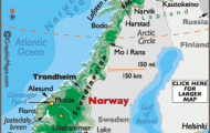
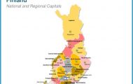
The Finnish town of Mikkeli, capital of the province of the same name, lies on one of the western arms of Lake Saimaa. As its Swedish name, Sankt Michel, indicates, it is named after the Archangel Michael. Life in this area can be traced back for more than a thousand years, and the first Christian community in the Savo region was established here, as the little stone sacristy of the wooden church of Savilahti still bears witness.
HISTORY. The village of Sankt Michel was granted the right to hold a market in 1745 and received its municipal charter in 1838. In 1843 it became the capital of the province and in 1 945 the see of a bishop. A garrison town as early as the 17th c„ it was the
headquarters of Marshal Mannerheimduringthethree campaigns ofthe Second World War-the Winter War of 1939-40, the war of 1 941 4 against Soviet forces and the Lapland War against German forces in 1944-5. Its role in the Second World War is commemorated by the Freedom Cross (a Finnish order) and the marshal’s batons in the town’s coat of arms.
A secondary school was established in Mikkeli in 1872. The town’s economy made great strides with the development of industry in the second half of the 19th c. Its principal industries are woodworking, textiles, metalworking and foodstuffs.
SIGHTS. The brick church dates from I 897, the Provincial Government Offices from 1 843, the Town Hall from 1 91 2 and the rural parish church, built in wood, from 1 81 6. From the hill of Naisvuori, in the middle of the town, thee are fine panoramic views (lookout tower; enclosed swimming pool cut from rock). To the NE, at the N end of Porrassalmenkatu, is the sacristy (kivisakasti) of the Savilahti church, built in 1320, which now houses a small Church Museum. To the SW, at
II Otavankatu, is the Savo Regional Museum (historical and ethnological collections). Also of interest are the Provincial Archives (documents from the 15th c. on) and the Headquarters Museum. On the SE outskirts of the town is an interesting geological feature, a glacier mill or sink-hole worn by swirling melt-water from a glacier some 1 0,000 years ago.
SURROUNDINGS. There are boat services from Mikkeli to the nearby resort (chalet village) of Pistohiekka, and also to Lappeenranta and Savonlinna. 5 km (3 miles) N of the town is the esker (a gravel ridge deposited by glaciers) of Pikku-Punkaharju, surrounded by water on both sides. 6 km (4 miles) S on Road 13 is the narrow sound of Porrassalmi, and 18 km (11 miles) beyond this, at Ristiina, are the remains of Brahelinna Castle, begun by Per Brahe but never completed.
Mikkeli Sankt Michel Finland Map Photo Gallery


