
Province: Gavleborgs Ian. Region: Gastrikland. Altitude: sea level. Population: 87,500.
HOTELS. Grand Central, Nygatan 45, 300 Esso Motor Hotel, Johanneslotsvagen 6, 375 Esso Motor Hotel, Hemlingby, 215 b„ SB; Aveny, Sodre Kungsgaten 31, 60 Gavle. Staketgatan 44,120 Boulogne, Byggmastargatan 1, 14 b. YOUTH HOSTEL.-CAMP SITE.
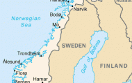
The busy commercial and industrial town of Gavle, between Stockholm and Sundsvall, is the administrative capital of the province of Gavleborgs Ian, which consists of the regions of Gastrikland and Hals-ingland. The town lies on both banks of the Gavled, which here flows into the Gulf of Bothnia.
Gavle is the largest and oldest town in Norrland, and with its modern port installations plays an important part in the export of timber and metal ore. It is also important and the main E-W junction for road and rail to Dalarua and Norway. After a fire in 1 869 which destroyed the districts N of the river the town was rebuilt.
SIGHTS. In the Town Hall Square (Rcidhustorget), immediately N of the river, are the Town Hall (1 8th c.) and the Town House (Stadshuset, 1803-5). From here two broad parallel streets, RSdmansgata and Norra Kungsgata, lead to the finely situated Theatre.
From Town Hall Square Drottninggata leads SW to the Trinity Church, the oldest building in the town after the Castle (1654; restored 1936-8 and 1954). Farther along the N bank of the river is the beautiful Municipal Park (Stadstrad-gcirden).
A little way S of the Town Hall, on the other bank of the river, the Castle, built by King Johan III in 1583-93 and renovated in 1 792, is now the governor’s residence. Tothe E ofthe Castle, on the far side of Sodra Kungsgata, is the interesting Museum, with material on the history of the town, modern pictures and sculpture; there is also a prehistoric collection which includes a boat of about a.d, 1 00, of the
type described by Tacitus in his Germania, found at Bjorke in 1948, and a small Persian lamp brought here by the Vikings. S of the Museum, in Sodra Centralgata, is the Folkets Hus (People’s House, 1946). On the southern outskirts of the town is the carefully renovated district of GAMLA GAVLE (Old Gavle), with many 1 8th c. wooden houses, the homes of artists and craftsmen. 1 km (about a J mile) W of the Castle is the Museum Silvanum (Museum of Forestry), with an interesting park.
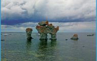
SURROUNDINGS. 3 km (2 miles) SE is the Jarvsta cemetery, with a runic stone. Tothe E of this, in Gavle Bay, we find the little resort of Furuvik (sandy and rocky beach), with an amusement and animal park. From here the road continues through the port and industrial town of Skutskar (woodworking) and crosses the Dalalv. Situated on the three arms of this river the town of Alvkarleby (pop. 10,000; Turist Hotell, 100 Pensionat Kronsater, 27 camp site) has a 15th c. church with fine wall paintings and a salmon hatchery. The once imposing waterfalls have lost much of theircharm through the construction of a hydroelectric power station. Above the power station, opposite the island of Flako, is a hydraulic laboratory with models of hydroelectric systems. 8 km (5 miles) NE is Sweden’s first wind-operated power station, an experimental unit with a tower 23 m (95 ft) high.
From Gavle Road 80 runs W to Falun (90). 3 km (2 miles) along this road is Valbo, with a 14th c. church and a runic stone of about a.d. 100. Beyond this are Mackmyra (iron foundry of 1885, now closed down) and Sandviken, an industrial town on the northern shore of the Storsjo (alt. 71 m (233 ft); pop. 71,000; Stadhotel, 74 Eos Car Hotel, 94 Gillet, 27 Hammaren, 60 b.). The dominant feature ofthe town is a large steelworks established in 1862, the oldest Bessemer works in Sweden. On the S side of the Storsjo is Arsunda church (c. 1450), with wall paintings and a medieval altar of Flemish workmanship.
Gavle Sweden Map Photo Gallery

