
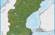
County: Telemark fylke.
The Norwegian county of Telemark extends N from the Skagerrak to the southern Norwegian uplands and the outliers of the Hardangervidda. Along the rocky coast are many bathing resorts; the interior is hilly and well forested, while the Har-danger is a desolate high plateau. Telemark played a part in the development of skiing techniques-the Telemark turn was quite popular between the First and Second World Wars.
Skien (pop. 30,000; Ibsen Hotell, 238 Mullerhotell Hoyer, 110 Mullerhotell
Heddal stave church, Telemark
Skien, 65 Skien Sportell, 52 two camp sites), on the N bank of the Skienselv, is a busy industrial town and the administrative capital of Telemark county. The church (1 894), with two-tall spires, stands on elevated ground. A little way S is a monument to the great Norwegian dramatist, Henrik Ibsen (1 828-1906), a native of Skien. To the E ofthe town, on the hill of Brekke (55 m 180 ft), is the Brekke Park (restaurant, summer theatre), with the Telemark County Museum (Fylkemuseum), which has a small Ibsen collection and a number of old Telemark houses. 2 km (1i miles) NE of the town is the 1 3th c. church of Gjerpen (restored 1 921). 6 km (4 miles) beyond, a narrow road on the left (signpost) runs up 750 m (i mile) to the Kikuthytta (325 m 1065 ft; refreshments), from which there are magnificent views.
From Skien, the Telemark Canal goes NW through the Norse and the Bandaksvatn, a picturesque lake enclosed by mountains, to Dalen (1 05 km (65 miles) from Skien). From the beginning of June to the middle of August, motor-ships sail from Skien to Dalen daily, taking about 10 hours.
50 km (30 miles) N of Skien as the crow flies, at the outflow of the Tinneiv into the Heddalsvann, is the town of Notodden (alt. 31 m (100 ft); pop. 9000; Centrum Hotel, 55 youth hostel; camp site), which lies on E76 from Kongsberg (163). W along E 76, Heddal stave church appears.
Heddal stave church, which dates from the mid-13th c. (restored in 1849-51 and again in 1952-4), is the largest of the old wooden churches of Norway. Notable features of the interior are the 14th c. wall paintings and the carved bishop’s throne. The windows were inserted during the 19th c. restoration. Across the road stands the separate belfry. Near the church is the Heddal District Museum.
Sauland (alt. 90 m (295 ft); Lovheim Turisthotel, 70 b.), at the junction of the Tuddal with the Heddal, has a church (1 857), erected on the site of an earlier stave church, and a storehouse (stabbur) of 1718.
An attractive detour can be made on a narrow road which runs up the Tuddal (to the right). In 22 km (14 miles), it comes to the late 1 8th c. church of Tuddal (468 m 1 535 ft). 6 km (4 miles) beyond this is the commanding Tuddal Heyfjellshotell (50 b.), base for
Gausta, Telemark the climb of Gausta (1883 m (6178 ft); skiing; view), the highest peak S ofthe Bergen railway.
E76 continues to Seljord (alt. 120 m (395 ft); GjestgivergSrden, 40 b.). To the E is the Lifjell, the highest peak of which is Gyrannaten (1550 m 5085 ft). On 25 November 1870, two Frenchmen who had escaped from the besieged city of Paris by balloon landed on the SW slopes of the Lifjell.
At Heydalsmo, Road 45 branches off on the left to Dalen, at the end ofthe Telemark Canal from Skien. Just before Dalen is the village of Eidsborg, with a stave church (1354, with later alteration), and also an open-air museum. Dalen (Bandak Hotel, 21 camp site) is in a fine location at the W end ofthe 26 km (16 mile) long Bandaksvatn.
From Dalen, Road 38 runs N past the steep rock face of theRavnejuv, and rejoins E76 at Amot.
At Haukeligrend is an important road junction where Road 12 goes off on the left to Kristiansand (163). E76 continues straight ahead and is known from here to Haugesund (1 97 km 123 miles) as the Haukeli Road. 0nlythefirst30km (20 miles) or so of this road are in Telemark; at Haukeliseter, it enters the county of Hordaland.
The Haukeli Road (toll), opened in 1886 and later partly re-aligned, is one of the finest routes to the southern part of the Norwegian W coast, passing through scenery typical of the southern Norwegian upland region. There are many unlighted tunnels, especially on the eastern part ofthe road.
From Haukeligrend, the road climbs up the Haukelifjell, passing at Botn (91 5 m 3000 ft) an old stabbur (wooden storehouse). Soon it rises above the tree-line, and the view to the W appears.
Haukeliseter (986 m (3235 ft); Haukeli seter Fjellstue, 88 VSgslid H0gfells-hotell, 100 b.) lies in a lonely mountain setting at the E end of the Stavann, on a long-established route through the mountains. It is now a tourist and winter sports resort (many cross-country ski trails). The road then enters the county of Hordaland. Ahead, to the right, are the sheer rock faces of the Store Nupsfonn.
The old road reaches its highest point on Dyrskar (1145 m 3757 ft), a pass barely exceeded in magnificence by the great Alpine passes. The modern road runs under a pass on the watershed between the Atlantic and the Skagerrak, in a tunnel 5682 m (3 miles) long.
The road continues through a desolate wasteland of rocks and snow, with several tunnels. To Roldal (390 m (1280 ft); Breifonn Hotell, 35 b.), on the lake ofthe same name, where there is a stave church (1 3th c„ with lateralterations) and an Iron Age cemetery. It then climbs the slopes of the Roldalsfjell, with a view ahead of the great Folgefonn glacier, rising to a height of 1654 m (5427 ft). Beyond the Seljestad gorge Road 47 goes off on the right to Odda on the Scirfjord (124). E76 now bears SW and follows the S shore of the Akrafjord.
Etne (Etne Krotell, 36 b.), on the fjord of the same name, has a wooden church (1 675, tower 1 930). There is good fishing in the Etneelv.
Haugesund (pop. 28,000; Saga Hotel, 140 Saga Maritim, 97 Neptun Pensjon, 69 Haugaland Hotell, 33 youth hostel; camp site), in the county of Rogaland, is a considerable port (connections with Stavanger and Bergen) and a busy industrial town, with an airport. The Town Hall also houses the Municipal Museum. An arched concrete bridge links the town with the little island of Risoy (fishing harbour; large port installations). – 2 km (1i miles) N of the middle of the town is the Haraldshaug, said to be the burial-place of Harald the Fair-Haired, whose naval victory at Stavanger in 872 is commemorated by a 1 7 m (55 ft) high granite obelisk erected in 1872, the 29 blocks of stone representing the tribes which he united into a single nation. To the S of the town is the Karmsund Bridge (690 m (750yds) long, 50 m (1 65 ft) high), which leads onto the island of Karmoy (area 176sq. km 69sq. miles). At the E end of the bridge are five standing stones, known as De fern dSrlige Jomfruer (The Five Poor Maidens). In Avaldsnes (2-5 km (1J miles) S) is St Olav’s Church (c. 1250). 6 km (4 miles) S of Avaldsnes is a large aluminium plant. At the S end of the island (35 km (22 miles) from the middle of Haugesund) lies the port of Skudeneshavn (pop. 1500); there is a ferry to Stavanger (244).
Telemark Norway Map Photo Gallery


