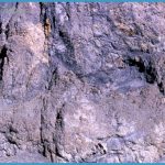
Lava is molten rock that reaches the earth’s surface, and rhyolite is one type of lava. Rhyolite lava, which formed the rocks exposed along Firehole Canyon Drive, is very stiff and does not flow readily (that is, it’s highly viscous), behaving much like asphalt or molasses. It’s so stiff that a lot of force is required to push it out from within the earth. As it’s being pushed out, it rips fragments from the rocks through which it’s flowing and carries them to the surface. If you stop at Firehole Falls, look closely at the rock face around the parking area. Portions of the rock consist of thin layers a pencil thickness or less that extend in the same direction as the original flow motion. This rock cooled very quickly.
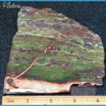
It didn’t have time to form crystals throughout, but ended up consisting mostly of what geologists term glass. The very dark layers you can see are glass, and the light layers are mostly very tiny crystals of the minerals quartz and feldspar. Embedded in the rhyolite are rock fragments that have sharp, jagged edges. These were the bits of rock that the lava ripped out and carried along as it came toward the surface. When it was flowing slowly, the lava’s temperature would have been about 1200°F (650°C). Where the moving surface cracked apart, it would have glowed a bright orange until cooled by the air. The northern edge of the Madison Plateau is where Firehole Canyon Drive begins, but the plateau extends southwestward about 30 miles (50 km) to the Idaho boundary. Imagine the number of flows and the total amount of lava that must have flowed to create this massive plateau.
The slow movement of rhyolite to form the Madison Plateau contrasts sharply with the massive explosive eruptions that resulted in the Yellowstone caldera. It was the caldera floor onto which the rhyolites later flowed. (2.0) S(2) Swimming area one of two places near park roads where the water is really warm enough for swimming. (Read about the other on 254.) The water of the Firehole here is a pleasant temperature about 75°F (24°C), neither warm nor cold. A stairway and a couple of rocky paths lead down to the water. There’s no lifeguard on duty, but park rangers check the area periodically. If you choose to swim here, you should keep your head out of the water entirely, to avoid contact with harmful microorganisms. (See 254 for details.) You will not be lonely: about 50 cars were parked along the road one recent warm July afternoon. The restrooms on the side of the road away from the river are large enough for changing clothes.
(2.2) 0 Just before Firehole Canyon Drive rejoins the Grand Loop Road, a sign announces Firehole Cascade. A blocked-off stretch of former highway provides a short walkway to the best of the cascades and to fishing access, for fly fishing only. Parking is along the side loop road. Continuing on the Grand Loop Road 2.4/14.6 Note the small, almond-shaped island just above the Firehole Cascades, as mentioned in Harry J. Norton’s 1873 guide, Wonderlandlllustrated. Here, according to Norton, two members of his party camped for the night and returned in the morning with glowing descriptions of the sighing and singing of the merry water-sprites who lulled them to sleep in their island couch . 0 This stretch of river abounds in rainbow trout, while further upriver, brook and brown trout are common.

