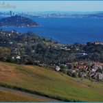
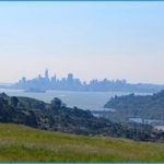
What’s Best: This wide-open ridge, easily accessible from central Marin, affords vistas of the entire North Bay and Mount Tamalpais watershed. Enjoy Marin’s first open space preserve.
Parking: Ring Mountain has access on both its north and south slopes, close by foot but far apart by car. For north-access trailheads: Take the Tamalpais Dr.-Paradise Dr. exit from Hwy. 101 in Corte Madera. Go east on Tamalpais Dr, turn right on San Clemente Dr, and continue to Paradise Dr. For south-access trailheads: Take E.-Blithedale-Tiburon Blvd. exit from Hwy. 101 and go east on Tiburon Blvd. More directions follow. Agency: Marin Open Space District
Tiburon Ridge: long walks (4.5 ml.); mid-distance walks (1.75 ml. to Hike- 2.25 ml.); Ring Mountain Summit: from Taylor Road (1 ml.), from Shepherd Way (2.25 ml.)
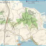
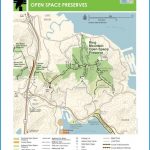
Ring Mountain Open Space Preserve and Tiburon Ridge Open Space to its west form the base of the Tiburon Peninsula, featuring a system of trails about 2 miles long and up to a mile wide. Ring Mountain, the 602-foot top of a rock-strewn grassy ridge, was established as a preserve by the Nature Conservancy in 1982 and transferred to the county in 1995. You’ll see blue and green schist, as well as igneous, greenish serpentine an inhospitable environment for most plant life. But connoisseurs will find rare and endangered plant species, including the precious Tiburon Mariposa lily. Walkers with keen eyes may also spot 2,000-year-old petroglyphs among the rock outcroppings.
Tiburon Ridge long walks: Both hikes traverse the Tiburon Ridge Open Space and Ring Mountain. Parking on the north side: Turn right where Paradise meets San Clemente. Then go left, or south, on Koch Road, a frontage road, for about .5-mile to its end, and park at a cul-de-sac. Go through the unsigned MCOSD gate and jog left to a trail that leads steeply up a short distance to Taylor Ridge Fire Road. Parking on the south side: Turn left just east of Highway 101 on Tiburon Boulevard, on N. Knoll Road. Follow N. Knoll up and turn right on Central to the end at gate amid a condo complex. Head steeply up the unpaved road for a long .25-mile to Taylor Ridge Fire Road.
For both north and south access points, head east on Taylor Ridge Fire Road. You’ll walk through the grass and oak woodlands of small Tiburon Ridge Open Space. After curving through some modest elevation gains, nearly a mile from the trailheads, you come to the MCOSD gate for Ring Mountain. From here, you begin a 200-feet gradual climb to Taylor Ridge. The high ridge, with its sitting rocks and circular view, is a worthy destination. Ring Mountain is the rounded peak to the south, with a near a water tank. From Taylor Ridge, you drop down about 150 feet through a saddle and continue for .75-mile, now on the Ring Mountain Fire Road.
The Tiburon Ridge mid-distance: On both hikes you reach the ridge fire road just east of the Taylor Ridge summit. Parking on the north side: Take Paradise Drive east and turn right on Westward Drive, which is just past Verona Place. Take Westward to its end, at a MCOSD gate. Take the winding trail up, beginning under pine and laurel trees and continuing by lichen-splotched rocks. You reach the fire road after a curving .5-mile, gaining about 200 feet in the process. Parking onthe south side: Heading east on Tiburon Boulevard, turn left on Reed Ranch Road, which is between Celia Way and Trestle Glen Boulevard. Take Reed Ranch all the way to the top and park at MCOSD gate.
A short trail, the Reed Ranch Fire Road, climbs gradually through grassland and meets the ridge fire road after about .75-mile. For both mid-distance hikes, continue east on the fire road, climbing steadily but gradually to Ring Mountain.
To the Ring Mountain Summit from Taylor Road, a short walk, begin on the north access, traveling east on Paradise Drive. Parking: After passing Robin Drive, turn right on Taylor Road and follow it to the top. A MCOSD gate sits beside trophy homes. Take the paved road that heads up to your right from the gate. You’ll pass a junction with the Ring Mountain Fire Road coming in on the right, and curve around left to the peak, which is to the left of a large water tank. Amazing views provide a lesson in the geography of the San Francisco Bay.
The Ring Mountain Summit from Shepherd Way is one of the best, but least-used trailheads in the preserve. Parking: Take either Tiburon Boulevard or Paradise Drive toward Tiburon. Turn on Trestle Glen Boulevard and at the top, turn up Shepherd Way to its end. The trailhead is an unmarked path leading out of the far end of the church parking lot. After about 200 feet, you come to a low pipe gate and a sign noting the Tiburon Ridge Trail. The trail becomes more of a road, passing a noble stand of eucalyptus, and gaining some 400 feet in total. Turn right when you hit the paved road at the top, and then veer left of the water tank. On the return walk you’ll head toward views of San Francisco and the towers of the Golden Gate Bridge.
Bike- The taxing Ring Mountain loop ride covers the length of the ridge. Begin at the south side access off Central Drive, as described inTiburon Ridge long walks above. Ride up from Central and turn right on the Taylor Ridge Fire Road. You’ll do a steep climb through sparse oak hills, hit a straight stretch, and reach a gate marking beginning of Ring Mountain Preserve. You then make a major pump up Taylor Ridge. After descending the ridge, you cross the saddle and climb again toward the summit, but not all the way. You’ll pass the road that comes in from Taylor on your left. Veer right, dropping over the last .75-mile. The road comes out at Shepherd Way, which you ride down to Trestle Glen Boulevard. Turn right, descending to Tiburon Boulevard. Cross over to Blackies Pasture and go right through the parking area to Greenwood Beach Road, which is closed to cars on this end. Follow Greenwood to
Tiburon Boulevard, near Central. Bay Wetlands Gallinas Creek By 1815, the Spaniards had been settling the Golden Gate region for 30 years, building a military stronghold at the Presidio and dividing Marin County up into a number of large rancheros, which were granted to those who had served the empire. The Coast Miwok who had lived these lands for thousands of years were subjugated as ranchero workers or conscripted by the missions. Seeking a site to build Mission San Rafael Archangel, a Spanish exploring party sailed up San Rafael Creek. They did battle with a village of Coast Miwok, and captured their leader, El Marinero or Chief Marin as we later named him.
Chief Marin was shipped off to be converted to Christianity at Mission Delores in San Francisco, and also enlisted to aid the Spanish in their ferry operations on the bay. In 1824, Mexico achieved independence from Spain. And Chief Marin, along with the last band of free Miwok, achieved independence as well. They fled in canoes, taking refuge on the two, tiny Marin Islands less than a mile offshore the marshlands of San Rafael Bay. Although facing superior numbers and armaments, the Miwok were able to defend the rugged island until food supplies ran out. The warriors were killed and captured. The very last Coast Miwok warrior, known to us as Quintin, made a run for the Golden Gate, but the tides were against him and Spanish vessels captured his canoe at today’s Point San Quentin now the site of the famous prison.
RING MOUNTAIN MAP SAN FRANCISCO Photo Gallery
During the remainder of the century, the marshlands of the east shore of Marin that extend north from Tiburon Peninsula to the Petaluma River, which is the border with Sonoma County were left relatively untouched, in spite of the Gold Rush fervor that shook the rest of the bay region. The wetlands had been a horn of plenty for the Miwok, but the new settlers applied different values. Although wondrously level, unlike the ridges of Mount Tamalpais, these mudflats were of no use: No timber, little deep water for fishing, no firm ground for railways, no pastures for grazing, no damn good. By the time California became a state, the wetlands were considered less-valuable extensions of the Mexican land grants that were sold to enterprising Americans who were in the right place at the right time.
Until rail lines were laid down along the dry western fringes of the wetlands, the creeks that ran through them were used for the transport of the timber, aggregates, and rock that was shipped to booming San Francisco.
Creeks were excavated to improve the waterways for barges. Corte Madera, San Rafael, Las Galinas, Rush and Novato creeks, as well as the Petaluma River, were used to float materials, along with dairy products and produce. When the rail lines to Tiburon and Sausalito were laid in the late 1800s, the waterways became less significanct. Dairy and grazing, on reclaimed marsh, continued on these eastern reaches of the rancheros.
But one part of the bay shore that saw its activity increase during the late 1800s was the north shore of San Pedro Mountain, the 1,000-foot high ridge that is the noted exception to marshlands on the bay coast. Chinese immigrants in the 1870s established a fishing village, mainly harvesting shrimp that hungry San Francisco couldn’t get enough of. Unlike other out-of-work railroad workers in California who found themselves doing labor on rancheros, the fishermen here established a community that has lasted into the 21st century now within the grounds of China Camp State Park, established in 1977.
China Camp shrimper George Quan, Barbier Park
Some 1,500 acres of San Pedro Mountain is included in the state park. The rest of the mountain’s considerable mass is in San Pedro Mountain Open Space Preserve and San Rafael’s undeveloped Barbier Park. With an intertwined system of trails that are enjoyed by hikers, dog walkers, cyclists, and equestrians, San Pedro Mountain is a recreational getaway that is not far from Marin’s urban area.
Recreational areas in the rest of the wetlands all east of the freeway corridor are a patchwork of different agencies, including the following: Marin County Open Space District; California Department of Fish and Game; San Rafael and Corte Madera park departments; and the Marin County Department of Parks. The Open Space Preserves, in addition to the lands on San Pedro Mountain, include Deer Island, Rush Creek, Santa Margarita Island, and Santa Venetia Marsh. Hikers can walk among the waterfowl on raised trails along the creeks and bay shores, or on oak islands woodland-and-grass hillocks that rise from the marshes. In the pre-canal and levee days, floodwaters and tidal surge surrounded these oak islands. Two state public areas, at Black Point and Corte Madera Marsh, offer trails onto the marsh habitat, as do the paths at Mclnnis County Park and Shoreline Park. Hikers can explore the creek canals at Mclnnis also, as well as at Bel Marin Keys, Shorebird Marsh, and Larkspur Landing.
Conversion of the marshlands to public lands began in the mid-1970s, as the public and scientists began to appreciate the fundamental importance of the wetlands where land and water mix, and where oceans meet the rivers to the overall ecology of the region. Where fresh water flows from rivers and meets salt water, turbulent eddies result, known as the salt-water wedge. Organic plant nutrients roil in the eddies, important to hundreds of marine species and attracting millions of tiny shrimp, which in turn feed bass and other fish. Plans are underway near Old Hamilton Field and Bel Marin Keys to restore a 2,500-acre tract of bay wetlands to its pristine condition.

