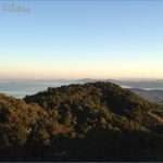
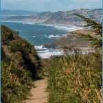
What’s Best: A short drive to long hikes up San Pedro Ridge through oak, laurel, and the ridge’s only redwoods to big views from San Pablo Bay to Tamalpais.
Parking: North side access: From Hwy. 101, take the Marin Civic Center-N. San Pedro Rd. exit and proceed east on N. San Pedro Rd.
South side access: Coming from south of San Rafael on Hwy. 101, take the central San Rafael exit; turn right on Second St. and then make first left, on Grand Ave. Coming from north of San Rafael on Hwy. 101, take the central San Rafael exit, turn left at first opportunity, and then turn left again, on Grand Ave. Agency: Marin County Open Space District; San Rafael Community Services.
Hike: North side access: Bayhills Drive to Nike viewing platform loop (2.75 ml.); Woodoaks Trail (2 ml.); South side access: San Pedro Ridge via Aquinas Fire Road (3.5 ml.); Gold Hill to San Pedro Mountain (4 ml.)
San Pedro Mountain Open Space Preserve is about 350 acres comprising the westernmost portion of a San Pedro Ridge landmass that also includes China Camp State Park and San Rafael’s undeveloped Harry A. Barbier Park. Combined, these three parklands are almost 2,500 acres. The county began purchase of the preserve in 1971, staving off ever-present pressure for residential development.
North side access: The Bayhills Drive to Nike platform loop begins up a paved road that is closed to all but local residents and leads to a splendid viewing platform. Parking: Just past Vendola Drive on your left, turn right on Sunny Oaks Drive. Follow the winding narrow street and turn left on Bayhills Drive. You’ll find limited on-street parking at the MCOSD gate, at the end of Bayhills. After about .75-mile walking up the steep road, you’ll see the Bay View Trail this is where you rejoin Bayhills after completing a loop.
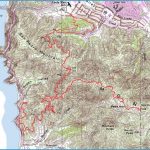
SAN PEDRO MOUNTAIN PRESERVE MAP SAN FRANCISCO Photo Gallery
At the top you gain some 700 feet on the mile-long paved section you’ll see a sign on your right, marking the San Pedro Preserve. To the left is a sign noting Harry A. Barbier Park, more than 500 acres that was purchased by the city in 1969 from “Ol’ Blue Eyes,” Frank Sinatra. Heading into Barbier Park, you come at once to the Nike Missile concrete platforms, which offer the best views from the San Pablo Ridge better than the peak itself. To continue the loop, take the road leading away from the Nike platforms. In less than .5-mile, you’ll see a China Camp trail junction. Go left, down the Back Ranch Fire Road but keep a lookout for Bay View Trail, which will be about one-eighth mile down on your left. Take this trail back Bayhills making sure to bear left on a spur trail about .5-mile after joining the Bay View Trail.
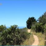
The Woodoaks Trail is the only hike that is mostly on trail rather than a fire road. Parking: Just past the Jewish Community Center on N. San Pedro Road, turn right on Woodoaks Drive and go to the end. Park at MCOSD gate. The trail takes you up through tawny madrones and maroon manzanita, with a few redwoods thrown into the mix. When you top out at a saddle on the San Pedro Fire Road, the Nike platforms (not a style of shoe) are about .75-mile to your left.
South side access: The Aquinas Fire Road climbs 300 feet to the ridge. Parking: From Grand Avenue, turn right on Mountain View Avenue. Then, in a series of quick maneuvers, turn left on Sienna, right on Dominican Drive, and right again on Aquinas Drive. Park at the top of Aquinas. You reach the San Pedro Fire Road about 1.25 miles from the eastern boundary of the open space.
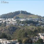
For the Gold Hill Grade to San Pedro Mountain hike (which may become your favorite in this area) you enter from Barbier Park and not the county open space. Parking: From Grand Avenue, at Dominican University, turn right on Locust and then veer left on Gold Hill Grade Road. Park at the end, at unsigned gate with a road leading up under a eucalyptus-and-laurel overstory. The Gold Hill hike features a mixed woodland forest, including a few redwoods. You’ll reach a paved utility road that services the telecommunications towers on the ridge. Turn left. After a short distance you pass the road coming in from the Main Drive access in Peacock Gap, and after another .5-mile you reach the unremarkable top of San Pedro Mountain, elevation 1,058 feet.
Bike: All roads on San Pedro Ridge are well used by cyclists and all require an initial climb. For an intermediate ride, try an Aquinas-Gold Hill loop, which involves about 600 feet of upping over a 3.5-mile course. Start at the Aquinas trailhead, which is very steep at the beginning. Then head along the ridge fire road, entering Barbier Park and passing the Nike platforms on the paved road. About .25-mile beyond the platforms, pass a trail on your left that leads to China Camp, after which you make a short, steep ascent to San Pedro Mountain. Continue south off the mountain and avoid any left-turning options. Just before the paved road ends, at a telecommunications installation, hang a right and descend Gold Hill Grade. At the bottom, ride back out to Grand
Avenue and finish the last portion of the loop on pavement.

