
What’s Best: Nearly two centuries of California living come together from the missions of the early 1800s to avant-garde films of today along the Victorian neighborhoods and parks around downtown San Rafael.
Parking: From Hwy. 101, take the central San Rafael exit. Coming from the south, you will be on Grand Ave; continue to Fourth St. and turn left. Coming from the north, you will be on Heatherton; turn right of Fourth St. For both exits, continue west on Fourth St. for a few blocks and park on street near Lootens Pl. Note: Additional parking in hike descriptions. Agency: City of San Rafael San Rafael Hill offers a great view of the city and its environs. Parking: Turn right on Court Street, just past Lootens Place on Fourth Street, and continue 2 blocks to Mission Avenue. Turn left on Mission and then make an immediate right on Wilkins Street, just before Boyd Park. Turn at next left, on Laurel and then veer right on Dollar Scenic Drive. Take Dollar to the top, just before Tampa Drive; you’ll see parking on your right and a fire road going up to your left. Walk up the road, an unsigned entrance to the upper part of Boyd Park. You’ll make lazy switchbacks on the main road, climbing 350 feet to the top, which is marked by a small telecommunications installation. On the way, notice along the road a series of masonry benches, a remnant of bygone days of the Dollar Estate. You’ll have view all the way a 3-D map of San Rafael directly below and distant looks at the San Francisco skyline and Sutro Tower.
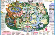
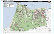
SAN RAFAEL MAP SAN FRANCISCO Photo Gallery
Immigrants of the Western world first took up full-time residence in Marin in 1817, when the Spaniards built Mission San Rafael the Archangel. Saint Raphael is the angel of bodily healing. The mission was established as a sanitarium for ill Coast Miwok and other Indians who could not recover from illnesses (brought by the Europeans) in the damp clime of San Francisco’s Mission Delores. The town, now Marin’s county seat, was laid out in 1850. Begin the San Rafael stroll by walking north on Lootens place to Fifth Street, jogging right one block to Nye Street, and continuing one block north again to Mission Street. Note: During weekday business hours, you may wish to pick up a San Rafael walking tour map from the San Rafael Chamber of Commerce at 817 Mission.
On Mission Avenue over the next six blocks are some ten buildings rated exceptional or excellent by the California Office of Historical Preservation: At 823-825 Mission is a Queen Anne Victorian built in 1881; at 828 Mission is a Stick-Eastlake house, built in 1884 and once the home of the city’s first mayor; at 1130 Mission is the Coleman House, built between 1849 and 1852, the oldest building in San Rafael; At Mission and B Street the entrance to Boyd Park is the Boyd Gate House, a High Victorian Gothic built in 1879, home to the Marin History Museum.
Mission San Rafael, Falkirk Cultural Center
For a woodsy side-trip, head into Boyd Park, featuring a children’s play set near the museum and a short trail leading around large redwoods. A little farther west of Boyd Park is the piece de resistance among Mission Avenue mansions: the Falkirk Cultural Center at 1408. Set on 11 acres of landscaped gardens, the 5,000-plus square-foot estate was built in 1888. In 1974, city taxpayers, led by Marin Heritage, bought the mansion, once home to steamship tycoon Robert Dollar. Today, Falkirk Cultural Center presents visual and performing arts, lectures, and art and poetry classes.
Wildcare
From Falkirk, backtrack and take C Street to your right one block to Fifth Street and turn left on Fifth. At 1104 Fifth is the site of Mission San Rafael Archangel. The existing church, built in 1949, is a close replica of the original Spanish Colonial structure. The mission was secularized and taken over by the civil government in 1833. It was raided for equipment, and even plants and trees, by General Mariano Vallejo, and torn down in 1861. The new church is open for mass.
From the church, head down A Street to Fourth Street, and turn right. Fourth Street is alive with a number of coffee shops, blogstores and restaurants, where you can stroll to pick out a sidewalk lunch or dinner spot. At 1108 Fourth is the Rafael Film Center, a major independent film venue for Northern California. Built originally for silent movies in 1920, and restored for talkies after a fire in 1937, the Rafael became a victim of the multiplex trend and closed down. Then filmmaker George Lucas, a Marin resident, and others helped restore the building and opened the center in 1998.
You may wish to drive the next section of the stroll, which ends at WildCare center. On foot, backtrack on Fourth Street, head right, or south, down B Street. Along B Street are four historic buildings rated from excellent to exceptional: The addresses are 848, 840, 810, and 724 all originally built the early 1880s. Cross busy Second Street, and into the palm-tree lined entrance to Albert Park. Walk past the large field and then left to WildCare center at 76
Albert Park Lane. Founded by Elizabeth Terwilliger, the grandame of Marin environmental conservation, WildCare gives treatment to thousands of orphaned and sick birds and wild critters. They also provide classes and nature hikes for thousands of children and adults throughout the Bay Area. Once inside the center’s gates, you are in an oasis among herons, pelicans, hawks, egrets raccoons, squirrels, who knows on the grounds of the wildlife hospital.