
Clear differences are apparent in the topography, climate, hydrog- South China raphy and flora between the fertile, subtropical highlands of the moist south and colder northern China. The smooth, shrouded landscape of the north Chinese plains and loess plateaux stands in stark contrast to the south with its more uneven, rugged contours and less peaceful character. There are no appreciable accumulations of loess and, as can be seen in the major lowland basins, to make the most of the soil, terracing and embankments have to be constructed and there is a wider range of cultivation methods in use.
The rias or fjord-like inlets which run between the broadly parallel peaks create favourable locations for ports.
The South Chinese Highlands occupy the major part of southeastern China. The mountains and hills of this important region on the south Chinese table have evolved from Sinian folded/recently raised low-level mountain chains. Powerful tertiary tectonic forces produced the disintegration of the old structures into horsts, tilt blocks and depressions. The succession of longitudinal and transverse valleys, of
Mountain scenery in Sichuan Topography Scenery in Guangxi narrow watergaps and broad lowland basins creates a changing landscape. With a different climate, geological processes have worked more intensively; chemical weathering has had a serious effect on surface decomposition and formation.
Situated between the low-level mountain chains of southern highlands and with a broad seam stretching into the adjoining Great Plain to the north are the outlying plains, the second independent topographical region of southern China. By far the most important area is the mouth of the Changjiang, a flat alluvial delta criss-crossed with channels where the river emerges into the Gulf of Hangzou. Also significant is the alluvial basin of the Xijiang delta with its almost tropical vegetation. The outlying plains are among the most densely populated regions of China with rice cultivation a major occupation although urban centres and industrial complexes proliferate.
The lowland basins along the course of the Changjiang as it meanders its way between the mountains also form part of the south Chinese plains. Densely populated and with an important farming role, retention basins act as a natural barrier in the perennial fight against the summer flooding. Amid the vast amphibian maze of waterways of the central Chinese plain, the Dongtinghu and Poyanghu Lakes, for example, serve as important overflow reservoirs.
The basins of the upper reaches in the mountains occupy a special place among the south Chinese plains. The Red Basin of Sichuan (Sichuan Pendi) is an important example. It is a massive depression with huge red sandstone deposits over 1000m/3250ft high emerging from the valley floor.
To the south-west of the Red Basin, plateau-like Sinian highlands with huge limestone tables rise up in front of steep, folded peaks, the eastern end of the Alpine-Himalayan range and the point where southern China gives way to Central and South-east Asia. Climatic and formative processes in the Guizhou, Yunnan and Shan plateaux of the
South-west Chinese Highlands have led to carbonation, or chemical corrosion and it is here that the idyllic landscape often associated with China – the distinctive karst towers and cones set in broad plains – is found.
The island of Hainan, separated from the mainland peninsula of Leiz-hou by the Straits of Hainan, sits on an outcrop of continental shelf and marks China’s most southerly point. The flatter northern section is covered with a layer of younger basalt pierced through by a number of volcanoes. Separated by a granite foreland, the southern peaks of the island’s Sinian uplifted fold mountains reach up to I867m/6123ft, but are subject to very severe decomposition as a result of what is known as “brick weathering”. Tropical rainforest still covers about 40% of the island’s surface.
The inner continental block of Central Asia with a surface area of about Central Asia 11 million sq.km/7 million sq. miles is the other major Asiatic region within Chinese territory and has a clearly defined border with East Asia. High altitude, inland drainage of the plateaux, a continental climate with extreme temperature fluctuations, remoteness and sparse population, together with a leeward position sheltered on all sides by mountains and the associated low rainfall are the main features which distinguish Central from East Asia.
Climate and altitude are responsible for further differences such as the natural vegetation and limited amount of land which may be used for agricultural purposes. Generally speaking, Central Asia can be subdivided into the Turan lowlands between the Kazakh rift and the Hindu Kush – not within China territory-and the Asian highlands with vast basins (Tibetan Plateau, Mongolian Plateau, Dsungarian and Tarim Basin, Turpan Depression) separated by the intervening mountain ridges (Kunlunshan, Nanshan, Tianshan, Beishan, Altaj).
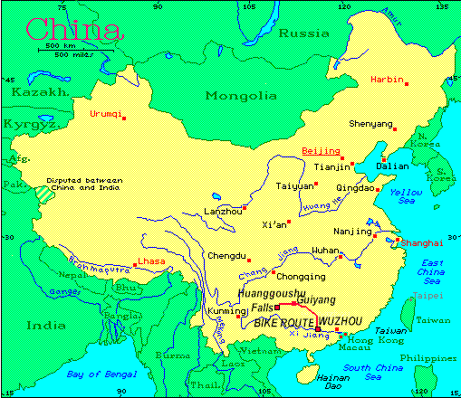
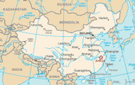
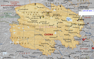
South China Map Photo Gallery


