
Trimiklini (Saittas) dam
Filagra on the left bank of Kouris, is a hamlet, one of the extremely few hamlets existing in Cyprus. The few dwellings on both sides of the main road, are used mainly as summer houses. Kato Amiantos. Kyprianos mentions that Amiantos was a large village, famous during the Roman times of its asbestos. Close to the central cafe of the village stand the relics of the old water-mill. It is here that a khan was situated, frequented by travellers from Morfou and Lefka on their way to Limassol. Tradition wants the Baths of Aphrodite to be lying north of the village where Rigaina, the queen of Cyprus, used to take her bath during the summer months. Karvounas is a very impressive saddle, between Troodos and Madari, being simultaneously a water divide separating the waters of Kouris and Kargotis. Pano Amiantos comprises the asbestos mine which started functioning after 1904, though it was well known much earlier. Judging from the writings of travellers and writers, asbestos extraction was carried out in ancient times. It was known to Hippocrates, Kallimachos, Strabo and many others. The ancient writer Apollonios as well as the doctor and historian Dioskourides mention the asbestos of
Cyprus. Kyprianos calls it cotton stone, whereas Lusignan likens the asbestos veins to human veins. The British granted rights of asbestos exploitation to Trombetta, who subsequently passed on the right to an Austrian Company. In 1942 the mine passed to four European countries and since then a systematic exploitation of the ore started. The method of mining was open cast. At the beginning the transportation of ore was carried out by overhead railway ending up in Limassol, while, a few years before the closing of the mine, lorries transported the ore to the port of export. Currently, the mine has been abandoned, with its scars visible on the landscape.
c) Villages south of Troodos
Route: Moniatis, Pano Platres, Arkolachania, Kalidonia Falls, Kato
Platres, Foini
Moniatis settlement is hidden amid rich and varied natural vegetation as well as dense deciduous trees. Within the village one can single out the medieval church of Archangelos Michail, which was restored in 1717. The church hosts a beautiful wood-carved iconostasis, a wooden cross and some old portable icons. Pano Platres is one of the few Cypriot villages which have adapted their buildings and particularly their hotels to the natural environment. Since the first decades of our century Pano Platres has been christened the king of Cyprus mountainous resorts. Kings and governors, enterpreneurs and millionaires, top writers and artists have been hosted in its hotels. Seferis, the noble laureate, impressed by the environment of Plates, wrote the following verse in his poem Eleni. “Nightingales do not permit you to sleep at PlatresThe visitor to Platres should not neglect to visit Psilo Dentro and sit for a few moments under the shade of the plane and the walnut trees. Close by and on the river bed a fishery has recently been set up, worth visiting. A few visits to neighbouring sites of interest, like Kalidonia Falls, Mesapotamos and Arkolachania, are recommended. Arkolachania, a picnic site, can be visited via Kato Amiantos, Saittas, Moniatis or even Platres.
Cyprus holidays | Travel
Mesapotamos falls
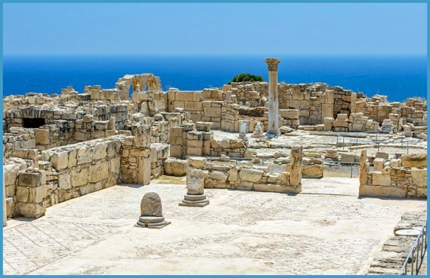
Probably the earthen road through Saittas could be chosen. Close by is the Mesapotamos falls, which could be called double rapids. The waters drop onto a platform and then onto a second one. Close by is also the old monastery of Mesapotamos which was founded in the 12th century. It is also probable that the dissolution of the monastery commenced during the Turkish rule and was completed during the first decade of the British rule. Currently, the church is steep-pitched and single-aisled, while the monastery building is two-storeyed. A coffee bar functions during the summer months under the shade of pine and plane-trees. Kalidonia falls, situated 3,5km north of Platres, have a height of 12 metres, exhibiting all characteristics of real falls. The rapids drop very abruptly, because they meet resistant gabbro rocks which have not yet been eroded away. At the base of the falls a pool has been formed, while the vapour produced spreads to some distance around. Kato Platres was known in the past by the name of Tornarides, from the numerous tornoi (wheels from which pottery was manufactured). Despite its beautiful and picturesque landscape, Kato Platres has not yet developed tourism, though urban dwellers, particularly from Limassol, build expensive villas. Foini is more famous for its pottery handicraft than for its picturesque landscape, its pleasant summer climate and its noteworthy cultural monuments. The inhabitants of Foini quite early located the red clay that existed in their village area and soon converted their houses into workshops of jars, “pitharia” (wine jars), bowls and lots of other pottery products. However, the number of potters has currently declined with a few women still pursuing this centuries-old craft of Foini. The emigre Theofanis Pilavakis, spent time and money to set up a museum, in the center of Foini, by collecting all types of pottery made by the inhabitants in the past centuries. It is a remarkable museum worth visiting. In the village lies one of the few waterfalls of Cyprus, namely that of Chantara. A fishery for trout production lies nearby. The monastery of Agioi Anargyroi was built in the 15th century, though, unfortunately, a fire in 1963 destroyed the church completely. It was rebuilt on the same site.
d) Around Troodos
Route: Troodos and the peak of Olympos, Nature trails
Troodos is the central mountain range of Cyprus with Olympos or Chionistra its highest peak (1951m), visible from all parts of Cyprus. Very often the snow on Troodos is heavy, enough to break the branches and the tender tips of the pine-trees. According to tradition, on the peak of Olympos there stood a temple of Venus (Aphrodite), while according to another tradition during the early Christian times close to Olympos peak stood various churches, though their remnants are no longer traceable. However, it is often mentioned that the foundations of the church of the Holy Cross were traced in 1910. Close by was the church of Archangelos Michail as well. It is also cited by authors, like Gunnis, that a Venetian wall was constructed on Olympos, though currently only mounds of igneous rocks arrayed in a straight line can be seen south of Chionistra. What is certain is that remnants of ice pits, where ice was preserved, still survive. The ice was transported late at night from Troodos to the towns. According to Italian priest and historian G. Mariti, the transportation of ice was carried out for centuries. Skiing at Troodos is a favourite sport for some Cypriots and a few foreigners alike.
Nature Trails in Troodos. Locals and foreigners can enjoy a few nature trails in Troodos during the four seasons of the year. Some of them are described below:
(a) Persephone Trail (Makria Kontarka). The trail starts from the local coffee-shop in Troodos and covers a return distance of about 6km on hard resistant rocks. The trail is about 1,5m wide with interesting types of vegetation on both sides. You meet the Troodos pine tree, which grows exclusively on the high peaks of Troodos, the wild apple-tree, the Troodos juniper, the sage, the rockrose and others. In autumn, fern takes a gentle yellow colour and appears as an extensive yellow carpet. The trail crosses nice stands with a superb view around.
(b) Kalidonia trail (Kryos Potamos-Kalidonia Waterfalls). The trail between Kryos Potamos and Kalidonia waterfalls, about 2km long, offers to those who follow it pictures of unsurpassed beauty. Kryos Potamos, tributary of Kouris, with its running waters all the year around together with its youthful, steep-sided, deep valley is the dominant feature of the trail. The luxurious vegetation along the trail includes chestnut trees, wild apple trees, wild plum-trees, Troodos juniper, gorse, fern, golden oak and bramble. Certainly, the very tall straight pinetrees, the alder, the plane-trees, the poplar-trees with ivy and lichens around their trunks are impressive. The end of the trail is the Kalidonia falls.
(c) The Atalanta Trail (Troodos Post Office – Chrome Mine). It is a 9km long trail round Olympos. You pass over eroded and weathered rocks with naked ground. The relief on the eastern part of the trail is more gentle, while on the western parts the scenery appears wild and rugged with deep, steep-sided valleys. You enjoy, while walking, the cool climate of Troodos, particularly during the summer months. Despite the fact that natural vegetation is not dense, nevertheless many forest trees and bushes appear before your eyes. Excellent views are offered from various spots towards the villages of Limassol, Pafos and Nicosia districts.
(d) Artemis Trail (Olympos circular trail). The trail, about 7km long, starts at the crossroads of the Chionistra and Troodos-Prodromos roads and proceeds in a circle round Olympos. You will encounter a variety of ophiolite rocks, like dunite, pyroxenite, harzburgite, pegmatitic pyroxenitic gabbro as well as a large variety of plants, like black pine trees, Troodos alyssum , sage, rockrose, etc. The installation of the Cyprus Ski Federation can also be seen.
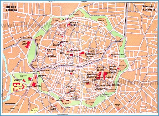
Cyprus Road Map Online
Route: From Karvounas to Troodos, Almyrolivado, Pasa Livadi
From Karvounas to Troodos. You can approach Troodos via Platres road or via Karvounas. The uphill road from Karvounas to Troodos is winding, despite being recently straightened and broadened. Before you reach Pano Amiantos, on your right hand side there stands a traditional fountain built in 1900, commemorating the construction of the Nicosia-Troodos road. Pano Amiantos appears with a few scattered houses on the right hand side and a severe wound or scar on the left. Almyrolivado is a unique excursion site, on the road Karvounas-Troodos, immediately after Pano Amiantos. In the middle of the valley piped water has been installed, while around grows a varied and rich natural vegetation. The visitor can see the centuries-old gigantic juniper on a gentle slope close by. As you explore the valley further west, you come across a camping site where tranquility and isolation prevail. Pasa Livadi lies east of Olympos, on the Pano Amiantos-Troodos road. The slopes around preserve their ruggedness. Pasa Livadi is a picnic site with all amenities, particularly the wooden tables and seats which comform harmoniously with the natural environment. Troodos, the highest settlement of Cyprus, appears with a few houses built with local building material, a large square and some centuries-old pine-trees with their tips broken by the snow. At Troodos horse- riding can be enjoyed.
e) Around Trooditissa Monastery
Route: Trooditissa Monastery, Xerokolympos, Kampin tou
Kalogirou, Trikoukia
Trooditissa Monastery lies on a steep slope of a tributary of Diarizos, south of the pine-clad Troodos. With its height of about 1.300 metres a.s.l. it is considered to be the loftiest monastery of Cyprus. What is fascinating about the monastery is its rich history and tradition. One could seek the history of the monastery in an isolated cave, close to the monastery. According to tradition, a monk carrying the icon of the Madonna, a painting of apostle Luke, left his native country and reached Akrotiri, close to the monastery of Agios Nikolaos of the Cats, around 762
A.D. Having spent about 25 years in the monastery of Agios Nikolaos, one day, guided by a bright star, he arrived at the present monastery of Trooditissa. He lived in a cave, known as the “Cave of Trooditissa”, until he died. The candle in the cave, after his death, was lit by shepherds, hunters and lumbermen.
Google Map of Cyprus
Snow-covered Troodos
Trooditissa monastery
It is this candle and the icon of Panagia that led people to build the monastery in about 990 A.D. Though the history of the monastery between 990 and 1570 A.D. is obscure, Trooditissa was looted and destroyed in the 16th century, like most monasteries in Cyprus. In 1585 the church was burnt but the monks managed to save the divine icon of Panagia. A new single-aisled church, entirely painted, was subsequently built. In 1842 the church was again burnt, though it was restored one year later. The church is now three-aisled, while the iconostasis is new. Between 1954 and 1974 the monastery was restored by increasing the cells and the rooms that can host guests. Many miracles are attributed to the icon of the Madonna. Childless women visit and pray for a child. A pair of buckles still lies near the icon and a woman who desires a child must wear them and her wish will be granted. Xerokolympos, an excursion site, very popular, albeit crowded, particularly on weekends for at least three summer months, lies close to the Trooditissa monastery and at small distance from Olympos. It is a narrow valley with two abrupt, almost vertical slopes, on an altitude of 1.500 metres a.s.l. A few wooden tables and seats, metallic equipment for barbecue, a few wooden bridges and traditional fountains constitute the facilities and embellishments of the excursion site. Kampin tou Kalogirou is an excursion site lying on a levelled off expanse of land before you reach Trikoukia. Wooden benches, piped water and metal appliances for the preparation of barbecue are the main facilities of the site. Trikoukia lies about 2km south of Prodromos. For a long time a Government nursery was functioning at Trikoukia, close to the steep-pitched church of Panagia Trikoukiotissa, relic of the historic monastery of Trikoukia. The monastery of Trikoukia was, most probably, built in the 13th or 14th century. The present arched church was restored in 1761. Internally the church is three-aisled with three doors. The windows are woodcarved preserving their original shapes. The most important icon is that of Panagia, a rain compelling icon, which is sheltered in the church and was much venerated by Greek and Turkish Cypriots alike. At the end of the 18th century the monastery was dissolved and its property fell into the hands of Kyrenia bishopric. Since 1923 as many as
10 hectares of Trikoukia’s land were converted into a government nursery, where deciduous trees were cultivated mainly for experimental purposes.
f) Lower Marathasa Valley
Route: Prodromos, Palaiomylos, Agios Dimitrios, Lemithou, Treis
Elies, Kaminaria
Prodromos appears on the landscape as a twin settlement: Kato (Lower) Prodromos is the original compact settlement, while Pano (Upper) Prodromos has been established, in the past few years, along the main road artery of Prodromos-Platres. Situated on a height of 1400m, Prodromos enjoys an extensive view towards many directions. The abandoned hotel Verengaria with its bulk and architecture dominates the landscape. The hotel was built in 1930 and played a significant role in the development of mountain tourism, particularly in the inter-war period as well as immediately after the second world war. Prodromos, with its plethoric natural vegetation, its waters and its healthy climate attracted many public buildings like the Forest College, children’s camping sites and, until recently, the Center of Agricultural Training. The Forest College is a tertiary Educational Institution, of three-years duration, training Cypriots and foreigners alike on forestry matters. The excursion site of Prodromos near the reservoir of Prodromos is a fascinating site for picnic. It lies on a height of about 1570m between Chionistra and Prodromos. The reservoir of Prodromos creates a beautiful spectacle with the shade of trees mirrored in its waters. Palaiomylos, the village with its narrow and meandering streets preserves some beautiful houses built in traditional mountainous architecture. Chair making is a handicraft still pursued by two craftsmen who work the timber. However, the most significant place of interest in the village is the church of Holy Cross, at the center of the settlement. It is a sixteenth-century church, originally single-aisled with a steep-pitched roof and flat tiles, later extended to the south and west. It is entirely painted, though dust and soot have covered many frescoes. Agios Dimitrios, is known for its climbing vines, which form emerald carpets. The “veriko” variety of grapes, which is destined for export, constitutes the principal income of the village. A few houses constructed with local building material, the church of Agios Dimitrios of the 18th century and the presence of a few potters still producing jars and other pottery products, are the basic characteristics of the village’s cultural heritage.
Gathering cherries at Kaminaria
Elia medieval bridge
Despite the isolation of Lemithou, a mountainous village, west of Prodromos, learning has been pursued quite early. The Commercial Secondary School of Mitsis started functioning as from 1912. The school was founded by emigre D. Mitsis, who earned money while living in Egypt. Two churches are worth mentioning. The church of Panagia is modern but contains a few old portable icons, like the 17th century icon of Panagia. At the top of a hummock lies a tiny early sixteenth-century church, dedicated to St. Theodoros. The church, originally painted with 16th century frescoes, was burnt in 1974. Now restored (1975), it does not contain paintings but modern icons. Treis Elies possesses some very interesting churches, like the timber-roofed church of Agia Paraskevi, at the entrance to the village, belonging to the 17th century. The principal parish church is devoted to Panagia. It is three-aisled, rebuilt recently on the ruins of an older church from which the iconostasis is preserved. A marble slab in the altar bears the inscription 1741. Noteworthy is a bronze reliquary which contains the bones of Agios Charalampos. Close by is the church of Archangelos Michail, timber-roofed, built in the middle of the 18th century. Most probably Kaminaria, the settlement south-west of Lemythou and
Treis Elies, obtained its name from the numerous ovens producing pitch with which the interior of jars and other pottery products was coated. The parish church of Agios Georgios in the center of the settlement, a 19th century building, is three-aisled, containing very old icons. There is a number of interesting chapels close to the settlement, some of which are the following: St Ermolaos, dates to the eighteenth century. St Basil, about 1,5km from the village, belongs to the sixteenth century. It has been restored by the Department of Antiquities. The church of Panagia, of the early sixteenth century, stands high above the village. A number of mural paintings still survive, like the painting with the donors as well as that of Panagia. Most probably the church of Panagia was a private church belonging to a prosperous family. A visit to the Venetian bridge of Elia, south of Kaminaria, in the Pafos Forest, is recommended.
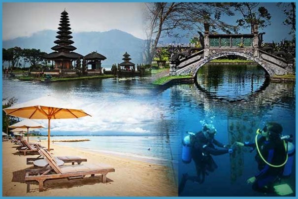
Top-Rated Tourist Attractions in Cyprus Photo Gallery


