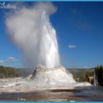
Described here are two routes you might take through Upper Geyser Basin. Any combination of walkways is possible, and there’s much to see. You might follow one of these Geyser Routes exactly, or plan your own route with the aid of the map on the next or the large map in the pamphlet that’s available both at the visitor center and from the boxes near Old Faithful Geyser. Geyser Route One: Geyser Hill and beyond NOTE: This trail is mostly boardwalk and is not fully wheelchair-accessible. Geyser Route One is about 3.5 miles (5.6 km) round trip and takes you to two of the two-star features listed in the Best Sights list in the Introduction. (Castle and Daisy Geysers are on Geyser Route Two, which begins on 98.) Extending your walk beyond Morning Glory Pool to Biscuit Basin adds another 1.5 miles (2.4 km) or so. For just the shorter Geyser Hill loop, totaling about 1.3 miles (2 km), start near Old Faithful Geyser as below, but return from near North Goggles Geyser (the area labeled (C) on the map and described on s 97-98).
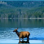
Starting from the visitor center, circle partway around Old Faithful Geyser, keeping the geyser on your left. There may be bison or elk around the area; allow them plenty of space. Marmots once lived under the old redwood boardwalks here. When the higher recycled plastic boardwalks were put in during 1997-98, coyotes, foxes, and the increased heat probably chased them away. As you walk toward the Firehole River, notice that Old Faithful and two or three other small features are on a huge mound some 200 feet (60 m) across and 12 to 15 feet (3.6-4.6 m) high. One or more hot springs must have been overflowing and depositing geyserite here for centuries to build such a mound. Yet one study hints that Old Faithful was probably born as a geyser not more than 700 years ago. The trail to Geyser Hill starts down the hill to the right across the Firehole River footbridge.

