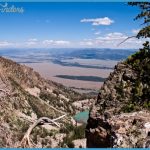
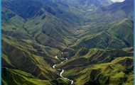
If the day is clear you can see, left to right (north to south): West Thumb Bay’s northern edge in middle ground. Absaroka Range in the distance these are 50-million-year-old volcanic mountains. Absaroka was the name that the Crow called themselves, meaning children of the large-beaked bird and pronounced ab-SAHR-o-ka. Due east of the viewpoint are four closely grouped, pyramid-shaped peaks: Doane, Langford, and Stevenson are inside the park (and all more than 10,000 ft/3050 m high), and Plentycoups, the highest at 10,937 feet (3334 m), on the eastern border. Duck Lake in middle ground, West Thumb Bay’s eastern edge in the background, with more Absarokas behind it. Flat Mountain just beyond cliffs. Mt. Sheridan at the far right and relatively close to the viewer (elevation 10,305 ft/3141 m). View ofYellowstone Lake and Absaroka Range from above Duck Lake the bay (elevation 9168 ft/2794 m), noted for its red Referring to this lake view, explorers David E. Folsom and Charles W. Cook wrote prophetically in 1869: We ascended the summit ofa neighboring hill and took a final look at Yellowstone Lake. Nestled among the forest-crowned hills which bounded our vision lay this inland sea, its crystal waves dancing and sparkling in the sunlight as if laughing with joy for their wild freedom. It is a scene of transcendent beauty which has been viewed by few white men, and we felt glad to have looked upon it before its primeval solitude should be broken by the crowds of pleasure seekers which at no distant day will throng to its shores.
For a similar view completely off the highway, take the Yellowstone Lake Overlook Trail from West Thumb Junction (described on 137). 19.0/0.4 I g Short, steep, unmaintained trail to Duck Lake [GEO.16] This little lake has an unusual geologic history. About 10,000 years ago a glacial ice dam gave way and allowed water to drain out quickly. Removal of the load of water drastically lowered the pressure above a group of hot springs, allowing the superheated water to flash to steam. Duck Lake is an explosion crater filled with water. There’s a good trail to Duck Lake from West Thumb Geyser Basin. 19.4/0.0 West Thumb Junction. For West Thumb Geyser Basin turn left (north), then turn right (east) immediately. For Fishing Bridge Junction and other points on the Grand Loop Road, also turn left (north). Grant Village and the South Entrance are to the south, Old Faithful Village to the west. West Thumb Geyser Basin and facilities at West Thumb are described on s 135-41 and Grant Village on s 132-34. II. THE BECHLER REGION Proceeding counterclockwise from the West Entrance, the next roads that go into the park are a pair of very short ones that don’t connect with any other Yellowstone roads. Thus, they can’t really be called entrance roads. This corner of the park is called the Bechler Region. More popularly, people call it the Cascade Corner, because it’s so well supplied with water and contains so many waterfalls.
It’s a great place for backpackers and horsepackers (and recently llama packers) who want to escape the crowds, but a long trip for most day visitors. Access to the Bechler Ranger Station and Cave Falls is on good paved and gravel roads from southeastern Idaho or via a very poor and primitive dirt road called Grassy Lake Road (or Ashton-Flagg Ranch Road), which runs outside the park’s southern boundary. We’ll only describe the better route here. If you want to take the Grassy Lake Road, inquire locally about its current condition before starting on it. From Ashton to the Bechler Ranger Station is 23 miles (37 km); from West Yellowstone to Bechler is about 80 miles (130 km).

