
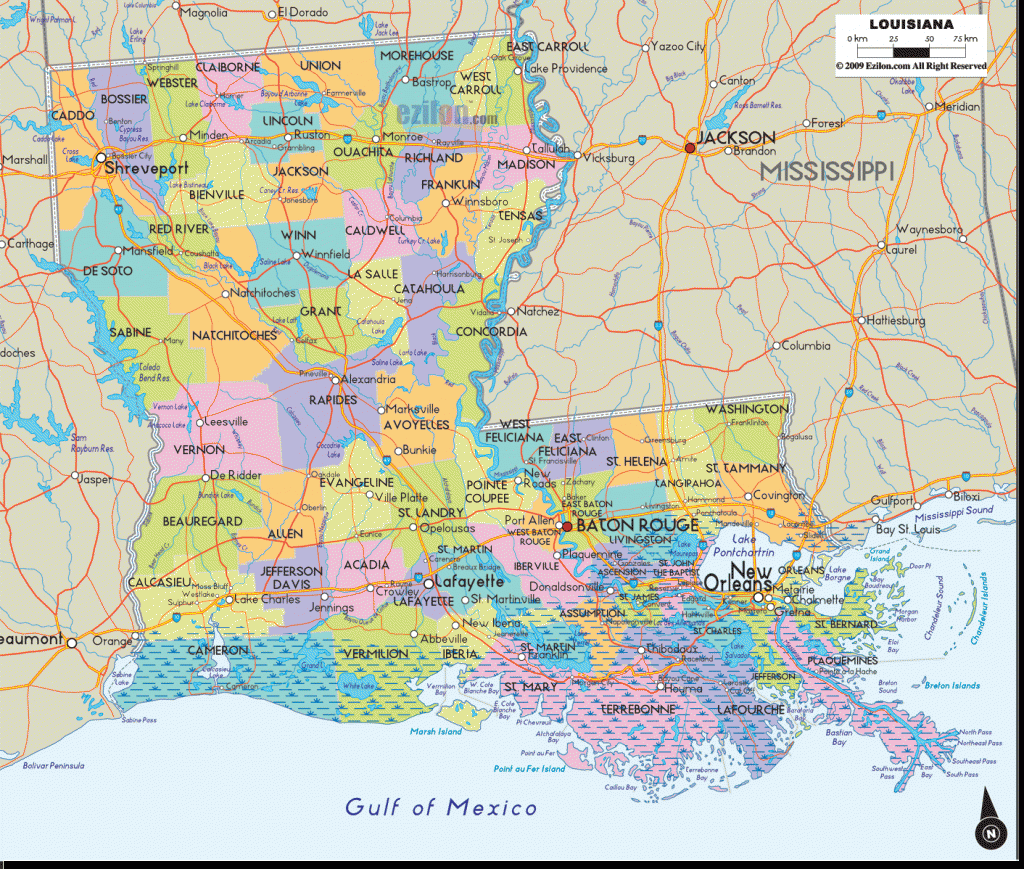
Louisiana Map
CHICOT STATE PARK
This attractive park centers around large Lake Chicot in southcentral Louisiana, in an area of bottomland hardwoods. It’s the only state park in Louisiana where backpacking and wilderness camping are allowed.
Activities: Backpacking and hiking are available on the 10-mile Chicot State Park Trail. Horses and bikes are not permitted in backcountry areas.
Camping Regulations: Camping is limited to five separate designated areas, most of which are located off of blue-blazed spur trails. Campfires are allowed. Pets are prohibited.
A permit is required in order to camp here. Permits are available at the park entrance for a nominal fee. Campers must file a trip plan describing their itinerary, intended campsites, and return time. Daily quotas are observed.
For Further Information: Chicot State Park, Route 3, Box 494, Ville Platte, LA 70586; (318) 363-2503.
Primitive camping is also permitted within several of Louisiana’s 38 Wildlife Management Areas, which are scattered around the state and add up to over a million acres of land.
Some of the individual tracts are quite large. Established trails are few. The primary use of these areas is for hunting and fishing, along with nature study and birdwatching.
For more information contact the Louisiana Department of Wildlife and Fisheries, P.O. Box 98000, Baton Rouge, LA 70898; (504) 765-2918.


