Michigan Guide for Tourist
PICTURED ROCKS NATIONAL LAKESHORE
67,000 acres. This long and narrow park, which is next to Hiawatha National Forest in Michigan’s Upper Peninsula, protects 40 miles of Lake Superior shoreline. There are sand beaches and dunes here, along with cliffs and caves, arches and other rock formations.
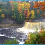
The National Lakeshore encloses a number of small inland lakes, ponds, and streams with waterfalls. Much of the area is forested with northern hardwoods and conifers, including pine and spruce, hemlock and fir.
Activities: Hiking and backpacking are available on almost 100 miles of trails, easy to moderate in difficulty. Among them is the 43-mile Lakeshore Trail, which extends the length of the park and is now part of the North Country Trail (see entry page 177).
Snowfall is abundant here in winter, and 17 miles of trails are groomed for cross-country skiing. Snowshoeing is another option. Canoeing is possible on two inland lakes, with advanced-level canoeing or kayaking also feasible along Lake Superior.
Camping Regulations: A permit is required to camp in the backcountry here. A limited number of permits may be obtained by advance reservation (recommended for July and August).
There are 13 designated camping areas, and these are located at regular intervals along the Lakeshore Trail. Camping is restricted to these sites. Campfires are allowed in fire rings, which are provided at all but two locations. Stoves are recommmended. Pets are prohibited in the back-country.
For Further Information: Pictured Rocks National Lakeshore, P.O. Box 40, Munising, MI 49862; (906)387-2607.

