
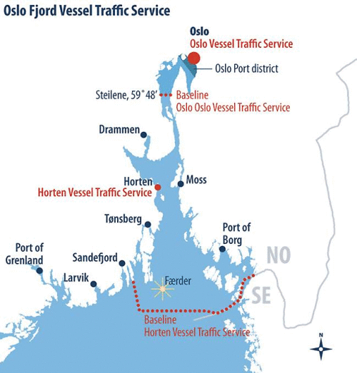
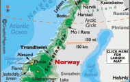
The Oslofjord, extending for more than 100 km (60 miles) northward from the Skagerrak to the Norwegian capital, is composed of wide basins, dotted with islands, and of narrow straits. Its rocky shores, of moderate height, are broken up by many little towns and settlements. The W side of the fjord was an area of early settlement (Viking ships); the trim towns on the E side can also look back on a long tradition. The beaches, with fine sand on the eastern shores, and the skerries are popular with the people of Oslo for vacations and at weekends. In addition to agriculture and timber-working, the Oslofjord has some busy industries, and the coastal towns are considerable commercial ports.
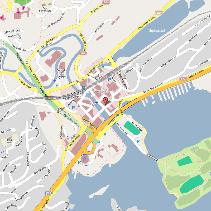
A road runs down the W side of the fjord, known as the Vestfold, to Sandvika, at the mouth ofthe Sandvikelv, Tanum (old church), Skaugum (residence of the Crown Prince) and Drammen (pop. 51,000; Park Hotel, 200 Central, 75 b.), main town of Buskerud, picturesquely set on the Dramsfjord, at the mouth ofthe Dramselv. The town has considerable industry and is an important port, shipping Norwegian timber, cellulose and paper. Itisalsothecountry’s principal port for the import of cars. In the market square, Bragernes Torg, is the attractive modern St Hallvard’s Fountain. In the Bragernes district is a conspicuous church (1 871). From here a toll road runs up in a spiral tunnel 1 700 m (1 850 yds) long (six turns, radius 35 m (115 ft), gradient 10%) on to Bragernesas (293 m (960 ft); Aspaviljongen summer restaurant; extensive views). A short distance NE is the lonely woodland lake of Klopptjern (alt. 21 8 m 71 5 ft). In the Stromso district, on the S bank of the Dramselv, are the Drammen Museum (history of the town; Buskerud county; Marienlyst, an 18th c. farmhouse) and a church of 1667 (altered in 1840).
Beyond Drammen there are two routes either down the W side of the Dramsfjord via Svelvik, ordirect by the island road to Sande, on the Sandebukt; then along the S side of this inlet to Holmestrand (pop. 9000; aluminium works; church, 1674; and limestone quarry).
The first town on the Oslofjord itself is the port of Horten (pop. 15,000; Central Hotel, 27 Baggerod, 40 b.), with Karl Johansvern (Naval Museum), the main base of the Norwegian navy until the end of the Second World War. From here there is a car ferry (45 minutes) to Moss, on the E side of the fjord.
Near here are the medieval church of Borre, with a magnificent Baroque interior, and, in the Borre hills, a small national park containing the largest group of royal graves in northern Europe (Yng-lingeastten; 6 large and 21 smaller burial mounds). On the fjord to the SE is the
The Oslofjord a paradise for sailing and boating enthusiasts
Bridge over the Svinesund between Norway and Sweden at Halden well-known seaside resort of Asgard-strand where the painter Edvard Munch lived for several years (memorial museum).
To the S, at the N end of the narrow Tonsbergfjord, is Tonsberg (pop. 13,000; Klubben Hotel, 175 Maritim, 50 Grand, 77 b.), which first appears in the records in the 11 th c. and is now the main town of Vestfold, with a considerable merchant fleet and a nautical college. The whaling ships sailed from here until whaling was stopped for conservation reasons in 1 951. At the near end of the town, on left, is a monument to the Polar explorer Roald Amundsen (1 872-1 928), who reached the South Pole in 1 911, flew over the North Pole in 1 926 and was lost on a flight to Spitzbergen in 1 928. On the W side of the town is the rocky Slottsfjell (Castle Hill, 63 m 206 ft), with a lookout tower and the foundations of the old castle of Tunsberghus (fine view of the harbour). Otherfeatures of interest are the Vestfold County Museum (on the Larvik road), with an Arctic section (whaling); the Cathedral (1858); and St Olav’s Church, the largest round church in the northern countries. A minor road runs S to the long straggling islands of Notterey and Tjeme (beautiful beaches), linked by a bridge; they lie between the Tonsberg-fjord and the Oslofjord.
To the SE, off the main road, is Sande-fjord, on the fjord of the same name. A former whaling port, it is now a seaside resort (pop. 7000; Atlantic Hotel, 65 Kong Carl, 45 b.). Whaling Museum; Seafaring Museum; monument to the whalers in the harbour; spa (sulphur and saline springs) to S of town.
To the SW is Larvik, at the N end of the Larvikfjord ( 174). To the S we come to the resort of Stavern (175), with the old coastal fortress of Frederiks-vern, and the smaller resort of Helgeroa and Nevlunghamn.
The road from Oslo down the E side of the Oslofjord, Ostfold, passes the attractive little resort of Drobak (fine wooden church, 1736) and reaches the town of Moss (pop. 26,000; Refsnes-Gods Hotel, 107 b.), located on the Mossesund, which runs between the offshore island of Jeloy and the mainland (bridge). The treaty of union between Norway and Sweden was signed at Moss (1 81 4). Car ferry (45 minutes) to Horten on the Wside of the fjord. To the S, on the shores of the fjord, is the resort of Larkollen.
The main road then comes to Sarpsborg (pop. 14,000; St Olav Hotell, 85 Saga, 120 Victoria, 30 b.), originally founded by St Olav in the 11 th it is now a busy industrial town (paper, cellulose, electrical engineering), with the Borgarsyssel Museum (old houses, ruined 12th c. church) and the beautiful KuISs Park. To the SW (Road 109) is the commercial and industrial town of Frederiksstad (pop. 30,000; City Hotell, 266 Victoria, 82 b; arts center). On the left bank of the river, reached by a bridge 824 m (J mile) long, is the Old Town (Gamlebyen), formerly fortified, with interesting old military buildings, some of them now occupied by craftsmen’s workshops. (Church of 1778; monument to King Frederik II, who founded the town in 1567.) Tothe W of Vikene there is a ferry to the island of Hank (beautiful coniferous forest), now a popular holiday resort (sailing school).
From Sarpsborg the main road continues past Tune (church, 1 060, later altered) to Halden (pop. 27,000; Park Hotell, 45 Grand, 60 b.), on the Swedish frontier. Known from 1 665 to 1 927 as Frederiks-hald, the town withstood several attacks by the Swedes, and, after suffering severe damage in a fire, was rebuilt on a regular plan in 1 826. It has a variety of industries, including woodworking and the manufacture of boots and shoes, and is the principal area for the timber trade in eastern Norway. On higher ground, tothe SE of the town, is the fortress of Fredrik-sten (alt. 113m (370 ft); fine views), built in 1661-71. An iron pyramid erected 1 860) commemorates King Charles XII of Sweden, who was killed during the siege of the town in 1718. Here, too, is the Municipal Museum (Haldens Minner”). Halden has a Theatre (1830, Baroque stage). On the E side of the town is the Atomic Energy Institute, with a reactor which came into service in 1 959.
Oslofjord Norway Map Photo Gallery


