
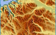
The fertile region of Valdres, in southern Norway, lies on both sides of the River Begna, which rises in the southern Jotunheim and flows into the Tyrifjord at Honefoss. It is an attractive valley, with many farms and great expanses of meadowland.
The base for a trip into Valdres is Honefoss ( 141), on the Begna, here also known as the Andalselv, which joins the Randselv to form the Storelv. 11 km (7 miles) E is the Ringkollen (702 m (2303 ft), extensive views). 15 km (10 miles) S, at Sundvollen (142), is the panoramic Kongens Utsikt (King’s View).
From Honefoss, E68 runs N along the E side of Lake Sperillen (23 km (15 miles) long). On the opposite side of the lake, the Hegfjell (1010 m 3314 ft) can be seen.
At the N end of the lake, where the Begna flows in, is the village of Nes. Here Road 243 goes off on the left to Hedal (13th c. stave church).
E68 now follows the right bank of the Begna to Begndal (camp site), in a forest setting. At Islandsmoen is an open-air museum (old houses).
At Bagn, a pretty straggling village (radio transmitter), a side road branches off to Reinli stave church (12th c.).
Fagernes (alt. 360 m (1180ft); Fagernes Turisthotell, 238 SP, SB; Fagerlund, 50 Valdres an autumn landscape, Lomen The Ryfoss, Valdres Fagernes Turistheim, 70 camp site), set between forest-covered hills at the mouth of the Neselv, which here forms beautiful waterfalls as it flows into the Strandefjord, is a popular tourist resort, a favourite with anglers. Valdres Folk Museum (old buildings, domestic equipment, musical instruments, weapons, etc.). From Fagernes Road 51 runs NW into the Jotunheim (147). E68 continues in a westerly direction along a number of small fjords and passing through Lomen (13th c. wooden church) and Ryfoss, to the S shore of Lake Vangsmjosa (19 km (12 miles) long), which it follows to Grindaheim (alt. 471 m (1545 ft); Grindaheim Turisthotell, 98 Mjosvang Pension og Motel, 85 camp site). The stave church which once stood here was disassembled and reerected at Briickenberg in Silesia in 1841; its place was taken by the white wooden church of Vang. Outside the church is a runic stone with the inscription Gose’s sons set up this stone for Gunnar, their brother’s son. A private road runs S from the village to the Helin National Park (area 35 sq. km 14 sq. miles). At (Dye, at the Wend of Lake Vangsmkjosa, is a 1 2th c. stave church, rebuilt from parts found under the floor of a later church. 11 km (7 miles) beyond 0ye, Road 53 turns off on the right to Lake Tyin (148), while E68 continues to the Sognefjord (239).
Valdres Norway Map Photo Gallery
