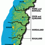
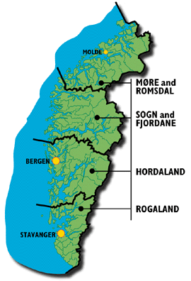
County: Sogn og Fjordane fylke.
Altitude: 2038 m (6687 ft).
The Jostedalsbre, between the Sognefjord to the S and the Nord-fjord to the N, is the largest ice sheet in continental Europe (almost 100 km (60 miles) long), comparable to the great icefields of Greenland.
Together with the adjoining icefields the Jostedalsbre covers an area of over 1 000 sq. km (380 sq. miles). Only a few low rocky hummocks emerge from the ice, the depth of which is estimated to be some 500 m (1650 ft). Twenty-six major glaciers reach down into the surrounding valleys, including the Tundbergdalsbre, the largest glacier in Europe after the Aletsch glacier in Switzerland. Since the ice of these glaciers, like the ice almost everywhere in Norway, has been retreating for many years, the ascent to the ice sheet has become steadily steeper and more strenuous.
At Roneid, on the Lusterfjord, Road 604 branches off Road 55, which runs along the N shore of the fjord, and makes its way up theJostedal, a rift running from N to S through the massive mountain plateau
Baydal glacier, Jostedalsbre and bounded on the W by the Joste-dalsbre. The road (many constricted passages) follows the course of the tumultuous Jostedalselv, passing through a number of wider basins in the valley.
25 km (15 miles) from Rpneid is Jos-tedal (alt. 201 m 659 ft), with a wooden church (1660). The road continues over the Hagebru. At Gjerde, a narrow road goes off on the left into the Krundal and continues to Bergset, with Hogenipa (1535 m 5036 ft) rearing above the valley on the S.
From Bergset there is a magnificent but strenuous climb (3 hours, with guide) past the Bjernestegbre to the Jostedalsbre, continuing overthe icefield to the Hegste Breakullen (1953 m 6408 ft); from there an hour’s walk NW, when an impressive view of the mountains along the Nordfjord appears; then a descent (sometimes difficult) through the Kvanndal to Nesdal, near the S end of the Loenvatn.
From Gjerde, Road 604 continues N. At Elvekrok (alt. 340 m 1116 ft) a private road bears off on the left to the Nigardsbre.
To the NW of the Jostedalsbre, Road 60 runs along the Innvikfjord. Near the E end of the fjord, at Olden (church, 1746-49, restored 1971), a road branches off and runs S into the

