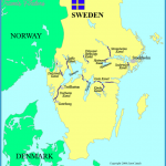
Provinces: Goteborgs och Bohus Ian, Alvsborgs Ian, Skaraborgs Ian, Ostergotlands Ian, Sodermanlands Ian, Stockholms Ian.
Regions: Bohuslan, Vastergotland, Ostergotland, Sodermanland, Uppland.
Rederi AB Gota Kanal, Hotellplatsen 2, S-41106 Goteborg; tel. (0 31) 17 76 15. Skeppsbron 20, S-11130 Stockholm; tel. (08) 24 04 79 and 21 72 25.
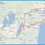
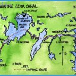
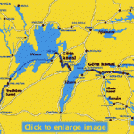
The three-day trip in one of the old passenger boats on the Gota Canal from Gothenburg to Stockholm (or vice versa) is one of the most memorable tourist experiences which Sweden has to offer. The total distance is 560 km (350 miles), of which 87 km (55 miles) are in canals. To overcome a difference in height of 91 5 m (300 ft) there are 65 locks on the route. The service operates from mid-May to the beginning of September.
The three boats which ply on the Gota Canal are old but have been modernised to bring them into line with modern A passenger boat in the Gota Canal Goteborg Oslo Oslo requirements. They do not carry cars, but the shipping company can arrange for the transport of passengers’ cars by land. Early booking is advisable, since these trips are very popular. It is possible to return by rail if desired.
HISTORY The construction of a waterway between Stockholm and Gothenburg so as to link the Kattegat with the Baltic was contemplated by Gustavus Vasa, but the first steps towards realising the project were not taken until the time of Charles XII (1 71 6). Two engineers, Swedenborg and Polhem, sought to bypass the Trollhatten falls by the construction of locks, but the levee was destroyed by driftwood in 1755, and thereafter the project hung fire until 1793. In 1 810 work began on the section of the canal between Lakes Vanern and Vattern, in Vastergotland (61-5 km (38 miles) long, with 21 locks). The Ostergotland section, between Motala and the Baltic, is 92-5 km (57 miles) long, with 37 locks. The construction of the canal is particularly associated with the names of Baron Baltzar Bogislaus von Platen and Daniel Thunberg. By 1 832 the whole length of the canal from Gothenburg to Mem on the Baltic was open for traffic. In those days the canal was an important industrial transport route; nowadays it is used almost exclusively by tourist traffic.
“Along the Gota Canal. Starting from Gothenburg (102), the boat sails upthe Gotaalv, passing the ruins of Bohus Castle, and comes in some 5 hours to Trollhattan (alt. 38 m 125 ft). While the boat is passing through the locks (height difference 32 m 1 05 ft) there is time to look around the power station. By the time (about 4 p.m.) the boat enters Lake Vanern at Vanersborg (alt. 44 m-1 44 ft) it has passed through 6 locks.
On Lake Vanern, the largest lake in Sweden, can be seen on the rightLacko Castle and the wooded hill of Kinnekulle (307 m 1007 ft). On the E side of the lake, at Sjotorp, is the beginning of the Vastergotland section of the canal, where during the night and early morning the boat climbs 47 m (154 ft) over a distance of 36 km (22 miles) by means of 20 locks, to reach Tatorp on Lake Viken (which serves as a reservoir of water for this part of the canal). At Lyrestad the canal is crossed by E5, and at Stora Lanthojden it reaches its highest point (91 5 m (300 ft) above sea level).
The boat continues through Lake Viken (area 46 sq. km (1 8sq. miles), depth 25 m 82 ft) and the adjoining Lake Botten (13 sq. km 5 sq. miles), with the Vaberg (226 m 742 ft) on the right, to enter Lake Vattern at Karlsborg. The passage across the northern part ofthe lake takes 4 hours. The boat reaches the eastern shore at Vadstena (time to drive around the
Stockholm town and see the castle), and then skirts the shore to Motala, where the main office and works of the canal are to be found and the Ostergdtland section ofthe canal begins. On the N bank ofthe canal can be seen the tomb of Baron von Platen. A series of 6 locks leads down into Lake Boren (alt. 74 m 243 ft), and the boat reaches Borensberg, at the E end of the lake, in the late afternoon. Over the next 22-2 km (1 4 miles), until the canal enters Lake Roxen at Berg (alt. 32-5 m 107 ft), it descends another 41-5 m (136 ft), passing through 16 locks. (Passengers travelling in the opposite direction can make a very early morning visit to Vreta Abbey, 20 minutes SE.)
Then follows a stretch of 26 km (1 6 miles) through Lake Roxen (alt. 32-5 m 1 07 ft) and the narrow Lake Asplang (27 m 89 ft), 5 km (3 miles) long. After this the canal descends (1 5 locks) to the old town of Soderkoping, which is reached about 5 a.m. (starting from Stockholm about 9 p.m.). From here it is 5 km (3 miles) to Mem, where the canal reaches Slatbaken, a 1 5 km (1 0 mile) long inlet on the Baltic. On its S side can be seen the tower of the ruined Stegeborg Castle.
From here the boat turns N through the skerries and the open Baltic, passing the inlet of Bravik and the steel town of Oxeldsund, and enters the long narrow Himmerfjard, which leads into the fjordlike Hallsfjard and the 5 km (3 mile) long Sodertalje Canal (constructed 1806-1 9, widened 1 91 7-24) linking the Baltic with Lake Malar.
At the industrial town of Sodertalje the boat passes through its last lock and continues for another 39 km (25 miles) along the E end of Lake Malar to reach Stockholm (247) about 6 p.m. on the evening of the third day.

